Select Item below to DOWNLOAD - Once item is selected, right click and choose 'save as'
edeb7786-ad39-4193-86c8-a1a0cc8a99c4
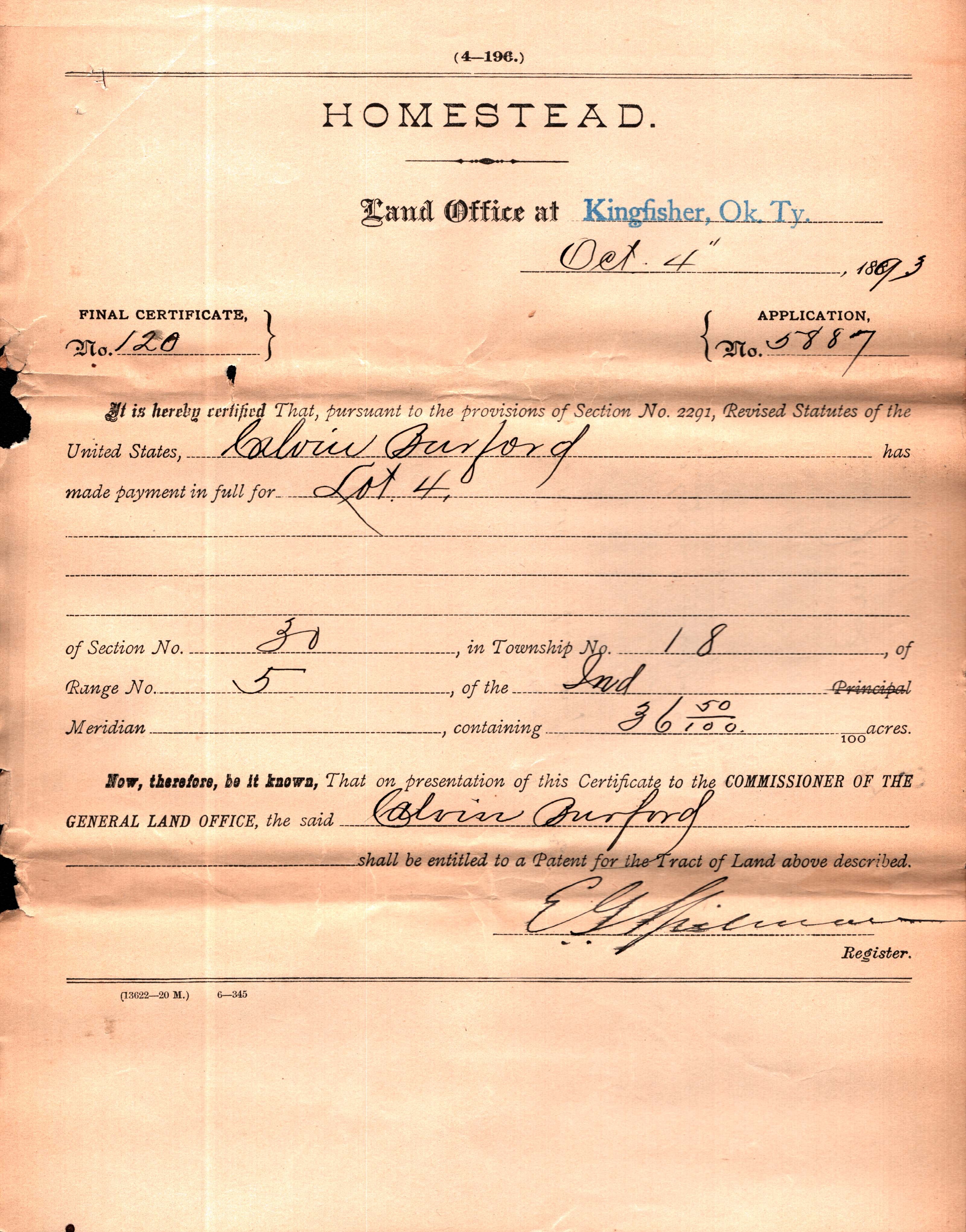
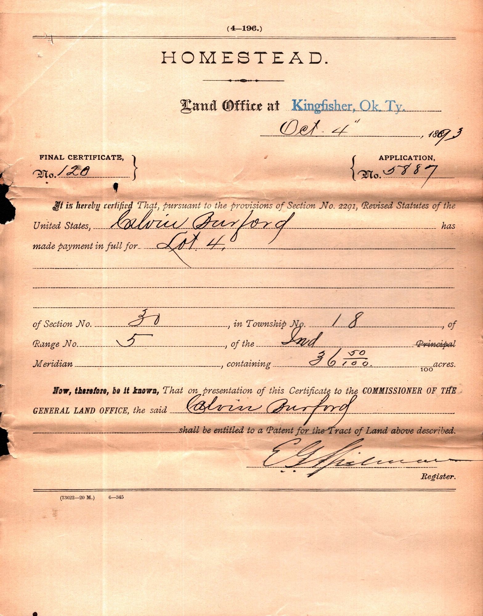
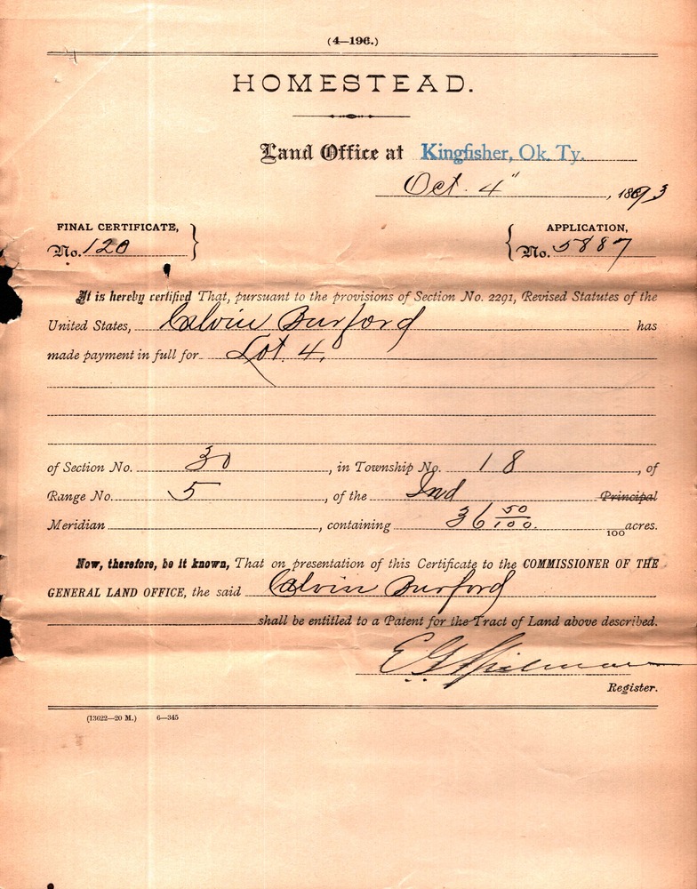
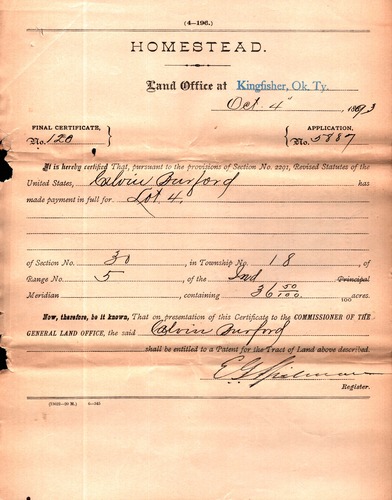
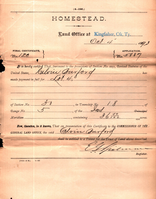
FINAL CERTIFICATE, No. 120, APPLICATION No. 5887
Yellowing scanned handwritten Homesteading case file. Transcribed text from the scan is found in the image description. Shadowing shows where the document was folded in three parts.
Transcribed document reads:
4—196
HOMESTEAD
Land Office at [stamp] Kingfisher, Ok. Ty.
Oct 4”, 1893
FINAL CERTIFICATE, No. 120)
Application No. 5887)
It is hereby certified That, pursuant to the provisions of Section No. 2291, Revised Statutes of the
United States, Calvin Burford, has made payment in full for Lot 4, Section 30, Township No. 18, of Range
No. 5, of the Ind Meridian, containing 36 50/100 acres.
Now, therefore be it known, That on presentation of this Certificate to the COMMISSIONER OF THE
GENERAL LAND OFFICE, the said Calvin Burford shall be entitled to receive a Patent for the Tract of Land
above described.
E.G. Spilman, Register.
(13622–20 M.) 6—345
Permission must be secured from the individual copyright owners to reproduce any copyrighted materials contained within this website. Digital assets without any copyright restrictions are public domain.
National Archives and Records Administration
Public domain:Full Granting Rights
Image
Homestead National Historical Park, Code: HOME
Homestead National Historical Park, Gage County, Nebraska
Latitude: 40.2879981994629, Longitude: -96.8339004516602
Latitude: 40.2879981994629, Longitude: -96.8339004516602
unknown
08/11/2022
Public Can View
Organization: Homestead National Historical Park
Tuesday, December 31, 2024 10:13:16 PM
Thursday, July 17, 2025 9:38:05 PM
BurfordCalvin_120_Kingfisher_29.jpg
Thursday, August 11, 2022 5:38:22 PM
jpg
1.2 MB
Scenic