Select Item below to DOWNLOAD - Once item is selected, right click and choose 'save as'
ec61a3d6-a7cf-483e-b781-217f30a326c1
State Map of New Mexico
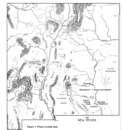
Map of New Mexico indicating the locations of Blackdom, surrounding towns, and Issac W. Jones' homestead.
Map of New Mexico indicating the locations of Blackdom, surrounding towns, and Issac W. Jones' homestead.
Permission must be secured from the individual copyright owners to reproduce any copyrighted materials contained within this website. Digital assets without any copyright restrictions are public domain.
New Mexico Department of Cultural Affairs, Office of Archaeological Studies
Public domain:Full Granting Rights
Image
Homestead National Historical Park, Code: HOME
Homestead National Historical Park, Gage County, Nebraska
Latitude: 40.2879981994629, Longitude: -96.8339004516602
Chaves County, New Mexico
Latitude: 40.2879981994629, Longitude: -96.8339004516602
Chaves County, New Mexico
unknown
Public Can View
Organization: Homestead National Historical Park
Address: 8523 W State Hwy 4, Beatrice, NE 68310
Email: home_information@nps.gov
Address: 8523 W State Hwy 4, Beatrice, NE 68310
Email: home_information@nps.gov
Sunday, April 11, 2021 3:43:49 PM
Sunday, April 11, 2021 3:43:49 PM
bh_blackdom_0012.png
png
214.2 kB
Scenic