Select Item below to DOWNLOAD - Once item is selected, right click and choose 'save as'
e7c5b774-1e48-47eb-980c-e7ae0a569967
BANDLongTrail_BJol2021.jpg
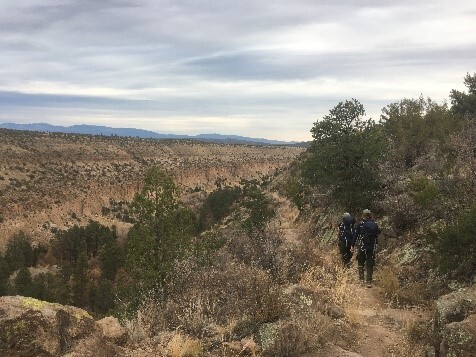
Two hikers head down a rugged trail that leads into a canyon. Blue mountains are far-off in the distance.
Hiking Long Trail down into Frijoles Canyon
Brianna Jol, NPS (2021)
Brianna Jol, NPS (2021)
All Rights Reserved:Full Granting Rights:Brianna Jol, NPS (2021)
Image
Bandelier National Monument, Code: BAND
Bandelier National Monument, New Mexico
Latitude: 35.8187789916992, Longitude: -106.357299804688
Latitude: 35.8187789916992, Longitude: -106.357299804688
01/01/2021
01/01/0001
Public Can View
Organization: Pueblo and Four Winds Fire Ecology
Friday, May 23, 2025 8:28:22 PM
Friday, May 23, 2025 9:12:38 PM
BANDLongTrail_BJol2021.jpg
Monday, January 1, 0001 12:00:00 AM
jpg
66.3 kB
Scenic