Select Item below to DOWNLOAD - Once item is selected, right click and choose 'save as'
e62cd858-1f6f-4509-b1a7-4d0e602bb1bd
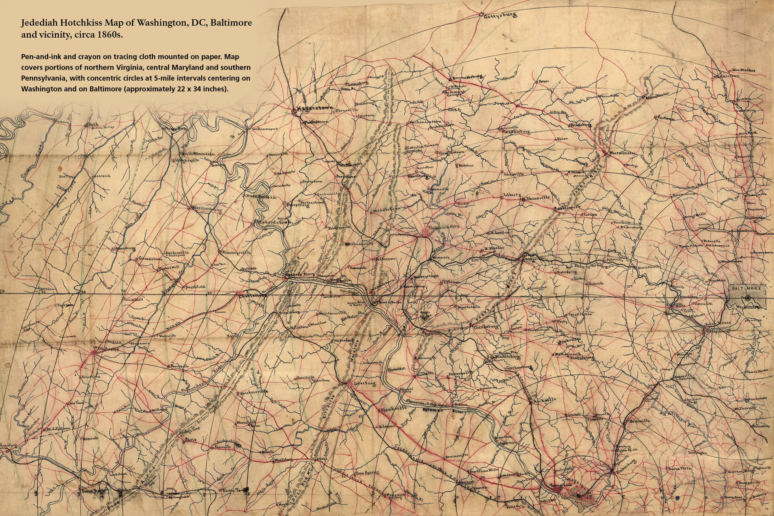
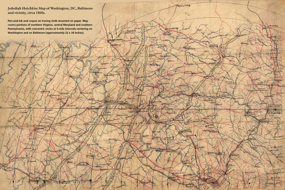
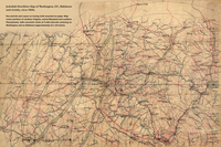
Jedediah Hotchkiss Map of Washington, DC, Baltimore and vicinity, circa 1860s
An exhibit identifies a hand-drawn map of great detail showing the topography, roads, and towns between Washington, D.C. and Baltimore.
Pen-and-ink and crayon on tracing cloth mounted on paper. Map covers portions of northern Virginia, central Maryland and southern Pennsylvania, with concentric circles at 5-mile intervals centering on Washington and on Baltimore (approximately 22 x 34 inches)
Permission must be secured from the individual copyright owners to reproduce any copyrighted materials contained within this website. Digital assets without any copyright restrictions are public domain.
NPS Exhibit; Map images courtesy of the Library of Congress
Public domain:Full Granting Rights
Image
Cedar Creek and Belle Grove National Historical Park, Code: CEBE
Cedar Creek and Belle Grove National Historical Park, Virginia
Latitude: 38.9937210083008, Longitude: -78.3142166137695
Latitude: 38.9937210083008, Longitude: -78.3142166137695
03/05/2013
01/01/0001
Public Can View
Friday, December 3, 2021 9:49:26 AM
Friday, December 3, 2021 11:43:03 AM
Hotchkiss maps 36x24-rev1.jpg
Monday, January 1, 0001 12:00:00 AM
jpg
936.7 kB
Scenic