Select Item below to DOWNLOAD - Once item is selected, right click and choose 'save as'
e4518018-dd1d-4c68-8124-47d2b500dae1
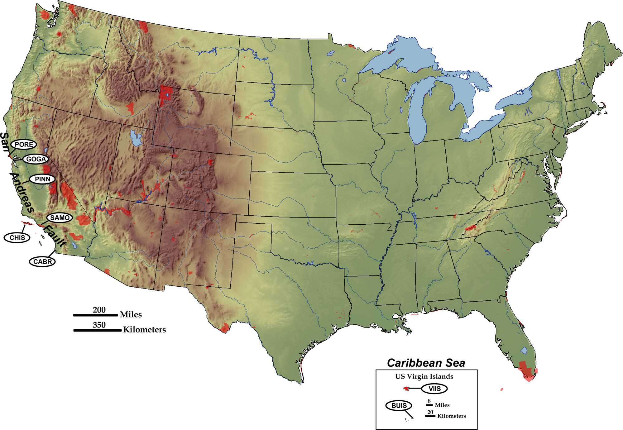
NPS Landscapes Developed at Transform Plate Boundaries
Shaded relief map of United States, highlighting National Park Service sites at Transform Plate Boundaries.
Shaded relief map of United States, highlighting National Park Service sites at Transform Plate Boundaries. Letters are abbreviations for NPS sites.
Permission must be secured from the individual copyright owners to reproduce any copyrighted materials contained within this website. Digital assets without any copyright restrictions are public domain.
Modified from “Parks and Plates: The Geology of our National Parks, Monuments and Seashores,” by Robert J. Lillie, New York, W. W. Norton and Company, 298 pp., 2005, www.amazon.com/dp/0134905172.
Public domain:Full Granting Rights
Image
Geologic Resources Division, Code: GRD
11/20/2019
11/20/2019
Public Can View
Friday, January 31, 2020 9:40:07 AM
Friday, January 31, 2020 9:40:07 AM
map of parks at transform plate boundaries@10x.jpg
Thursday, November 21, 2019 12:15:40 AM
jpg
1.7 MB
Scenic