Select Item below to DOWNLOAD - Once item is selected, right click and choose 'save as'
ddc44029-7eaf-48c9-af2a-96eef011e509
FRHI.1002.DN.2013
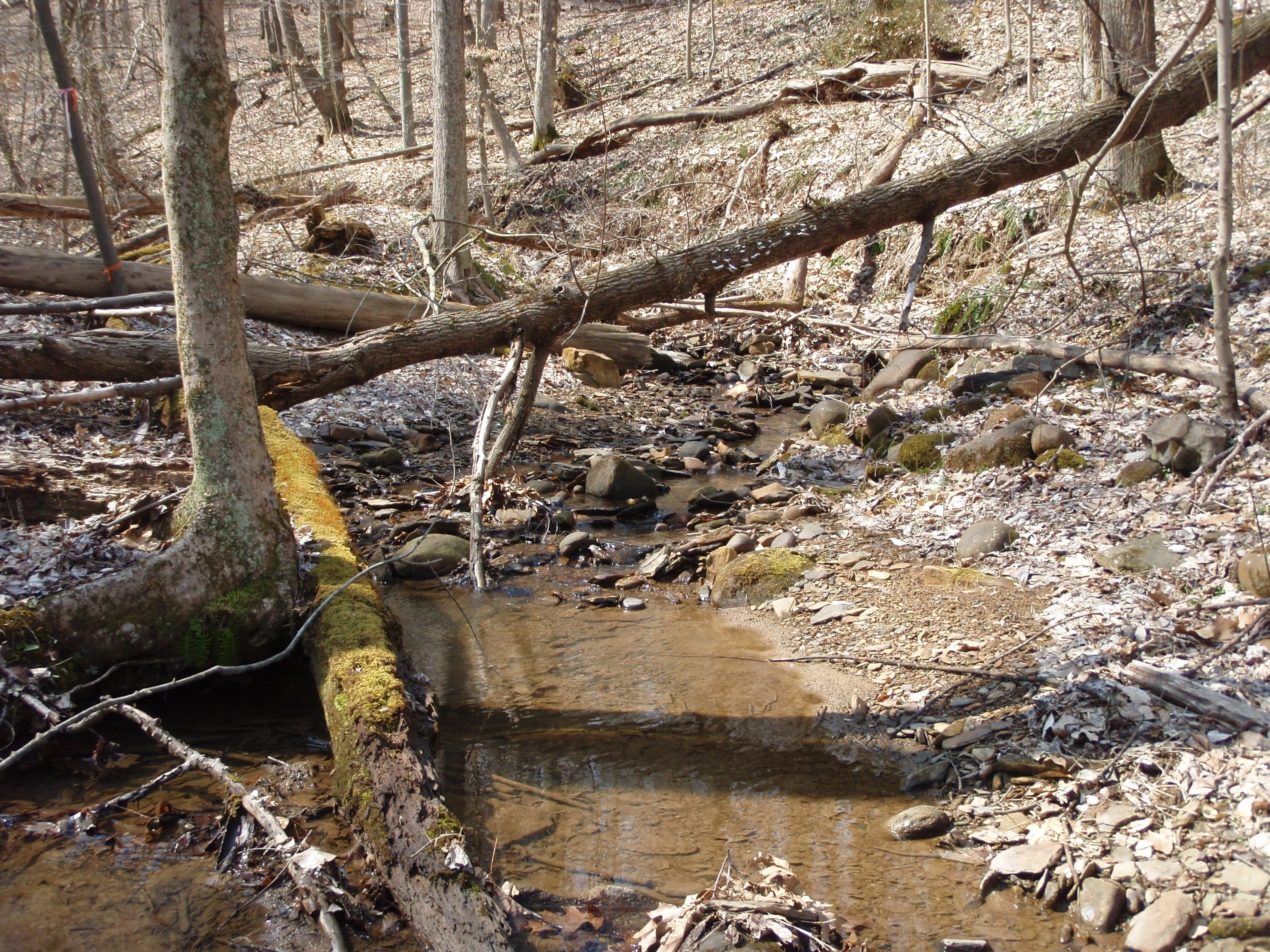
Site visit photo showing the upstream (UP) or downstream (DN) view of a wadeable stream reach taken during benthic macroinvertebrate monitoring at Friendship Hill National Historic Site.
Site visit photo showing the upstream (UP) or downstream (DN) view of a wadeable stream reach taken during benthic macroinvertebrate monitoring at Friendship Hill National Historic Site.
U.S. National Park Service
This digital asset is in the public domain. When using this asset for any purpose, including online, use: Photo Credit: U.S. National Park Service.
Photo Credit: National Park Service
Public domain
Dublin Run - FRHI.1002, (ERMN Stream Site Name)
, FRHI.1002, (ERMN Stream Site ID)
, FRHI.1002.DN, (ERMN Stream Site Up and Down)
, ERMN Benthic Macroinvertebrate Monitoring, (ERMN Project Name)
, FRHI.1002, (ERMN Stream Site ID)
, FRHI.1002.DN, (ERMN Stream Site Up and Down)
, ERMN Benthic Macroinvertebrate Monitoring, (ERMN Project Name)
Image
Friendship Hill National Historic Site, Code: FRHI
Eastern Rivers and Mountains Network, Code: ERMN
Eastern Rivers and Mountains Network, Code: ERMN
Friendship Hill National Historic Site, Fayette County, Pennsylvania
Latitude: 39.7755012512207, Longitude: -79.9253005981445
Latitude: 39.7755012512207, Longitude: -79.9253005981445
Title: NPS DataStore Project
URL: https://irma.nps.gov/DataStore/Reference/Profile/2229360
Title: Eastern Rivers and Mountains Network Website
URL: https://www.nps.gov/im/ermn/index.htm
URL: https://irma.nps.gov/DataStore/Reference/Profile/2229360
Title: Eastern Rivers and Mountains Network Website
URL: https://www.nps.gov/im/ermn/index.htm
2013/04/09
01/01/2013 - 12/30/2013
Public Can View
Organization: Eastern Rivers and Mountains Network
Position: Data Manager
Position: Data Manager
Friday, August 9, 2024 3:09:12 PM
Friday, August 9, 2024 3:09:12 PM
FRHI.1002.DN.2013.JPG
jpg
2.8 MB
Monitoring