Select Item below to DOWNLOAD - Once item is selected, right click and choose 'save as'
d65c73f3-f796-4173-b29c-8d2fd7ec6c5d
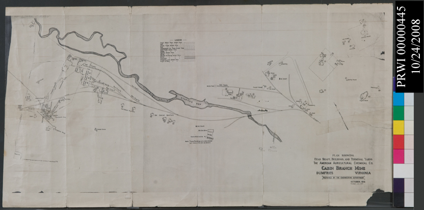
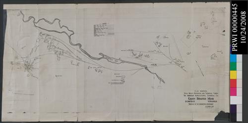
MAP - CABIN BRANCH MINE
This image was captured during the WASO funded Digital Imaging Project aimed at increasing access to NPS collections through digital photography. http://www.nps.gov/hfc/products/cons/museum-mgmt.htm
U.S. National Park Service
BLACK AND WHITE LAYOUT SHOWING ARRANGEMENT OF BUILDINGS AND ROADS<CRAT THE CABIN BRANCH MINE OPERATION<CRAN ENLARGED AND REGULAR VIEW OF MINE LOCATION<CR<CRPROBABLY GIFT TO PARK FROM JOHN LAUCH
Permission must be secured from the individual copyright owners to reproduce any copyrighted materials contained within this website. Digital assets without any copyright restrictions are public domain.
Public domain:For further image information contact:Prince William Forest Park, 18100 Park Headquarters Road Triangle, VA 22172-1644 Tel. (703) 221-4706.
Image
Prince William Forest Park, Code: PRWI
Dumfries, Prince William Forest Park, Prince William County, Virginia
Latitude: 38.589900970459, Longitude: -77.3863983154297
Latitude: 38.589900970459, Longitude: -77.3863983154297
10/24/2007
10/24/2007
Public Can View
Thursday, January 20, 2011 11:09:02 AM
Thursday, August 10, 2017 10:16:39 AM
PRWI00002167.jpg
NIKON CORPORATION NIKON CORPORATION, NIKON D200
1/100 sec at f / 16
70 mm
ISO 100
Wednesday, October 24, 2007 7:59:04 PM
jpg
211.0 kB
Museum
,
Map