Select Item below to DOWNLOAD - Once item is selected, right click and choose 'save as'
d5bd8687-2809-46de-853e-1f2cd9acef5f
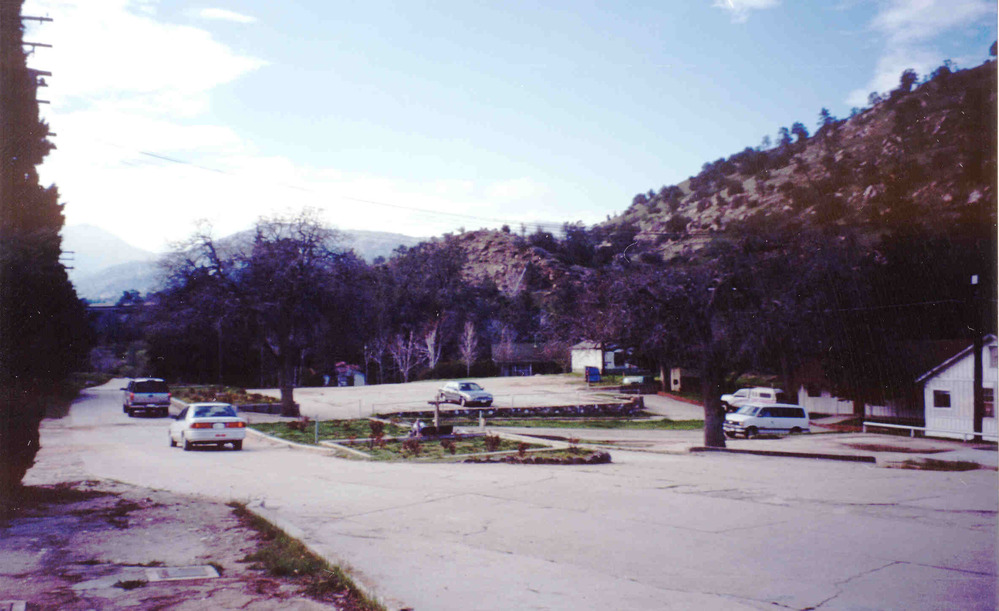
Historic Image of the Area That is Now the Chavez Memorial Garden and Gravesite
A faded photo shows cars driving near a flat grassy area with a low cross and small bushes.
A photograph from the 1980s shows the location of Cesar Chavez's gravesite in La Paz long before its designation as a national monument.
Permission must be secured from the individual copyright owners to reproduce any copyrighted materials contained within this website. Digital assets without any copyright restrictions are public domain.
Courtesy Cesar Chavez Foundation
Public domain:Full Granting Rights
Image
Cesar E. Chavez National Monument, Code: CECH
Cesar E. Chavez National Monument, Kern County, California
Latitude: 35.2239837646484, Longitude: -118.558891296387
Latitude: 35.2239837646484, Longitude: -118.558891296387
1980s
01/01/0001
Public Can View
Friday, January 15, 2021 6:23:27 PM
Friday, January 15, 2021 6:23:27 PM
Before 8.jpg
Monday, January 1, 0001 12:00:00 AM
jpg
170.1 kB
Scenic