Select Item below to DOWNLOAD - Once item is selected, right click and choose 'save as'
d5222b8e-5287-4e62-9488-319b1f331411
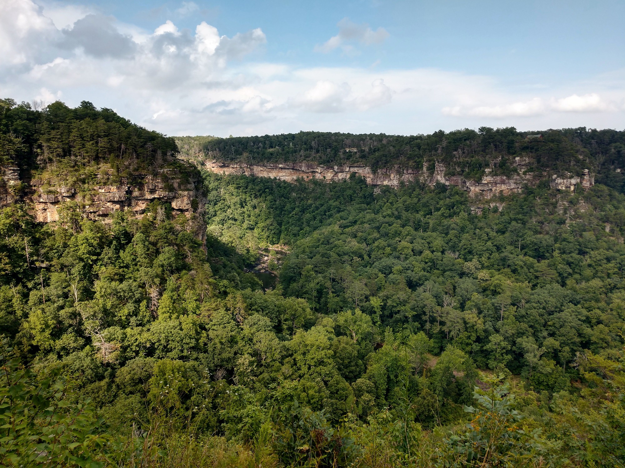
Eberhart Point
Bear Creek and an unnamed creek flow into Little River from either side of the canyon below Eberhart Point, with the sandstone cliffs towering above them. The Eberhart Trail begins at this overlook.
Bear Creek and an unnamed creek flow into Little River from either side of the canyon below Eberhart Point, with the sandstone cliffs towering above them. The Eberhart Trail begins at this overlook.
Permission must be secured from the individual copyright owners to reproduce any copyrighted materials contained within this website. Digital assets without any copyright restrictions are public domain.
NPS / Matt Switzer
Public domain:Full Granting Rights
Image
Little River Canyon National Preserve, Code: LIRI
Little River Canyon National Preserve, Alabama
Latitude: 34.3865394592285, Longitude: -85.6289367675781
Latitude: 34.3865394592285, Longitude: -85.6289367675781
06/23/2019
06/23/2019
Public Can View
Tuesday, March 17, 2020 3:23:34 PM
Tuesday, March 17, 2020 3:23:34 PM
Eberhart Point (lower) - 23 Jun 2019.jpg
motorola motorola, moto z3
1/637 sec at f / 2
3.75 mm
ISO 50
Sunday, June 23, 2019 10:47:58 PM
jpg
3.6 MB
Scenic