Select Item below to DOWNLOAD - Once item is selected, right click and choose 'save as'
d1f2479f-146e-446c-87c6-6ebabdb86e5b
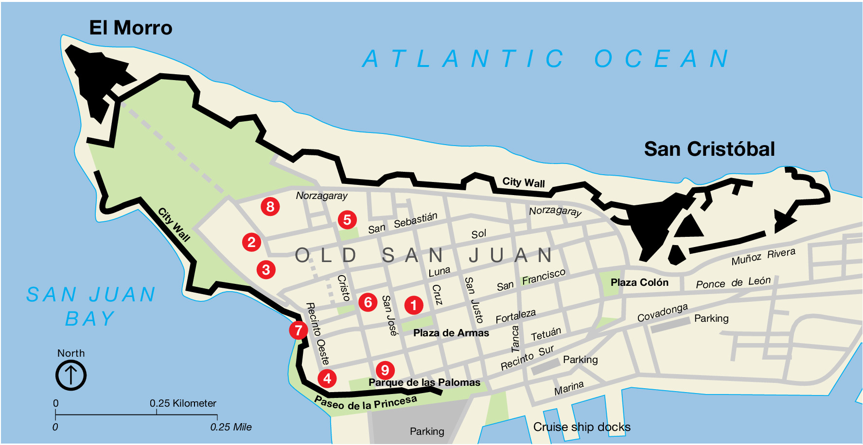
Old San Juan Map - San Juan National Historic Site
Map of Old San Juan as part of San Juan National Historic Site in Puerto Rico, an off-white chevron-shaped island with one end pointing northwest and other end pointing due east, The Atlantic Ocean and San Juan Bay are light blue.
Screen-viewable file; Adobe print production files can be downloaded from the Compressed zip Version link
Map Projection: Other; Map Type: unassigned
U.S. National Park Service
The National Park Service maps are government produced and are in the public domain. Anyone may, without restriction under U.S. copyright laws: Reproduce the work in print or digital form; Create derivative works; Perform the work publicly; Display the work; Distribute copies or digitally transfer the work to the public by sale or other transfer of ownership, or by rental, lease, or lending. Please note, a user who modifies and/or republishes National Park Service maps are responsible for any problems encountered with the maps, due to their change or modification.
Public domain
Document
San Juan National Historic Site, Code: SAJU
San Juan National Historic Site, Puerto Rico
Latitude: 18.4688205718994, Longitude: -66.1158828735352
Latitude: 18.4688205718994, Longitude: -66.1158828735352
2011-04-25
Public Can View
Person: Harpers Ferry Center
Organization: US National Park Service
Address: Harpers Ferry Center, Harpers Ferry, WV
Email: HFC_Cartography@nps.gov
Organization: US National Park Service
Address: Harpers Ferry Center, Harpers Ferry, WV
Email: HFC_Cartography@nps.gov
Monday, May 2, 2022 10:26:34 PM
Friday, September 26, 2025 11:37:29 PM
SAJUmap1.pdf
pdf
29.1 kB
Map