Select Item below to DOWNLOAD - Once item is selected, right click and choose 'save as'
CC8DFF08-155D-4519-3EE76F90B6267A74
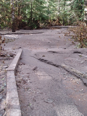
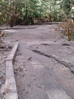
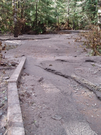
Trail through Grove of the Patriarchs
Silt and debris covers a trail, the edge of wood framing visible on one side.
After the flood, silt covers the trail through the Grove of the Patriarchs.
U.S. National Park Service
Permission must be secured from the individual copyright owners to reproduce any copyrighted materials contained within this website. Digital assets without any copyright restrictions are public domain.
NPS
Public domain:Full Granting Rights
Image
Mount Rainier National Park, Code: MORA
Mount Rainier National Park, Washington
Latitude: 46.865608215332, Longitude: -121.682601928711
Latitude: 46.865608215332, Longitude: -121.682601928711
7/16/2010 12:30:36 PM
Public Can View
Tuesday, January 2, 2018 11:11:22 AM
Friday, December 23, 2022 8:58:01 PM
CC8E09CD-155D-4519-3E5BB5C3346F2EF3.jpg
OLYMPUS CORPORATION OLYMPUS CORPORATION, u30D,S410D,u410D
1/30 sec at f / 3.1
5.8 mm
ISO 80
Tuesday, November 7, 2006 7:14:19 PM
jpg
127.1 kB
Scenic