Select Item below to DOWNLOAD - Once item is selected, right click and choose 'save as'
CC520A53-155D-4519-3EA24DBBFCCE9F8B
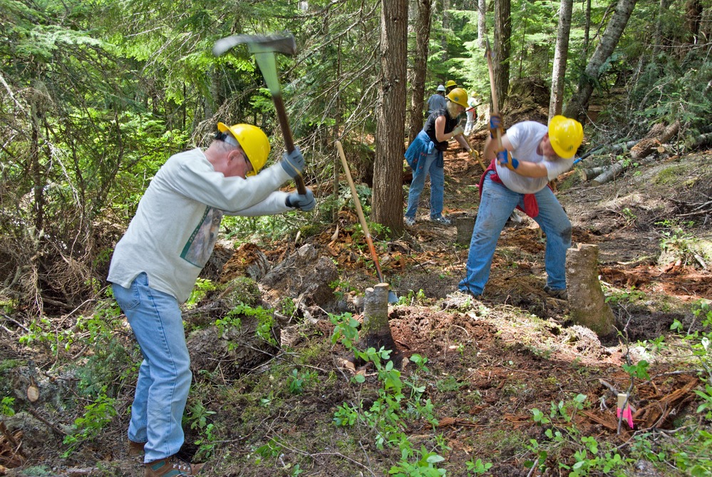
Wonderland 1 - Before
People use tools to clear small trees and plants from the route of a new trail.
Volunteers work on creating a new section of the Wonderland Trail west of Cougar Rock Campground, to replace a section washed out by the flood of November 2006.
U.S. National Park Service
Permission must be secured from the individual copyright owners to reproduce any copyrighted materials contained within this website. Digital assets without any copyright restrictions are public domain.
Public domain
Image
Mount Rainier National Park, Code: MORA
Mount Rainier National Park, Washington
Latitude: 46.865608215332, Longitude: -121.682601928711
Latitude: 46.865608215332, Longitude: -121.682601928711
7/16/2010 12:55:40 PM
Public Can View
Tuesday, January 2, 2018 11:09:30 AM
Wednesday, December 21, 2022 11:41:08 PM
CC53C1E9-155D-4519-3ECF10BDDB87DF1A.jpg
Monday, July 2, 2007 11:30:30 PM
jpg
9.5 MB
Scenic