Select Item below to DOWNLOAD - Once item is selected, right click and choose 'save as'
caf1dc5a-10c7-4997-b1fb-3ef0d695bf17
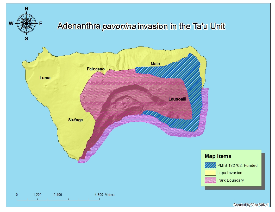
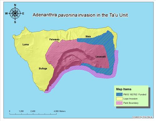
Map of Lopa invasion on Ta'u Islands American Samoa, circa March 2013
This proposal focuses on completing the removal of lopa from Ta'u Island. Approximately 8,950 acres of Ta'u forest adjacent to the park is invaded by lopa.
Permission must be secured from the individual copyright owners to reproduce any copyrighted materials contained within this website. Digital assets without any copyright restrictions are public domain.
Public domain
Image
National Park of American Samoa, Code: NPSA
National Park of American Samoa, American Samoa
Latitude: -14.2589998245239, Longitude: -170.688995361328
Latitude: -14.2589998245239, Longitude: -170.688995361328
03/14/2013
Public Can View
Thursday, March 14, 2013 2:11:49 AM
Thursday, August 10, 2017 9:10:45 AM
NPSA-23aacdd47b3e40fb83dc5244e39c0b44.jpg
Monday, January 1, 0001 12:00:00 AM
jpg
377.6 kB
Map
,
Budget