Select Item below to DOWNLOAD - Once item is selected, right click and choose 'save as'
c8798571-c01e-4e6e-83bf-c0f0e3baf2db
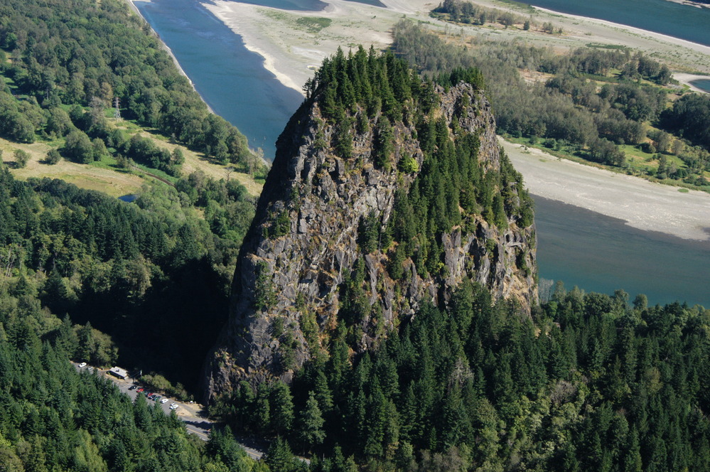
Beacon Rock
Photograph of Beacon Rock towering over the landscape with the Columbia River in the background.
Photograph of Beacon Rock (Washington), which is part of the Boring Volcanic Field.
The Missoula Floods removed all but the central core of this cinder cone about 15,000 years ago. Note the cars and building in the lower left corner of the photograph for scale
Permission must be secured from the individual copyright owners to reproduce any copyrighted materials contained within this website. Digital assets without any copyright restrictions are public domain.
USGS photograph, available at
https://volcanoes.usgs.gov/observatories/cvo/cvo_boring.html
Public domain:Full Granting Rights
Image
Fort Vancouver National Historic Site, Code: FOVA
Fort Vancouver National Historic Site
Latitude: 45.623851776123, Longitude: -122.662101745605
Latitude: 45.623851776123, Longitude: -122.662101745605
09/02/2010
09/02/2010
Public Can View
Friday, July 2, 2021 3:31:02 PM
Friday, July 2, 2021 3:31:02 PM
23_FOVA_Beacon_Rock_USGS_Photo.jpg
NIKON CORPORATION NIKON CORPORATION, NIKON D100
10/3200 sec at f / 9
38 mm
Thursday, September 2, 2010 9:00:46 PM
jpg
3.0 MB
Scenic