Select Item below to DOWNLOAD - Once item is selected, right click and choose 'save as'
c7af54e6-ffb6-40d6-8864-caf04df45f1f
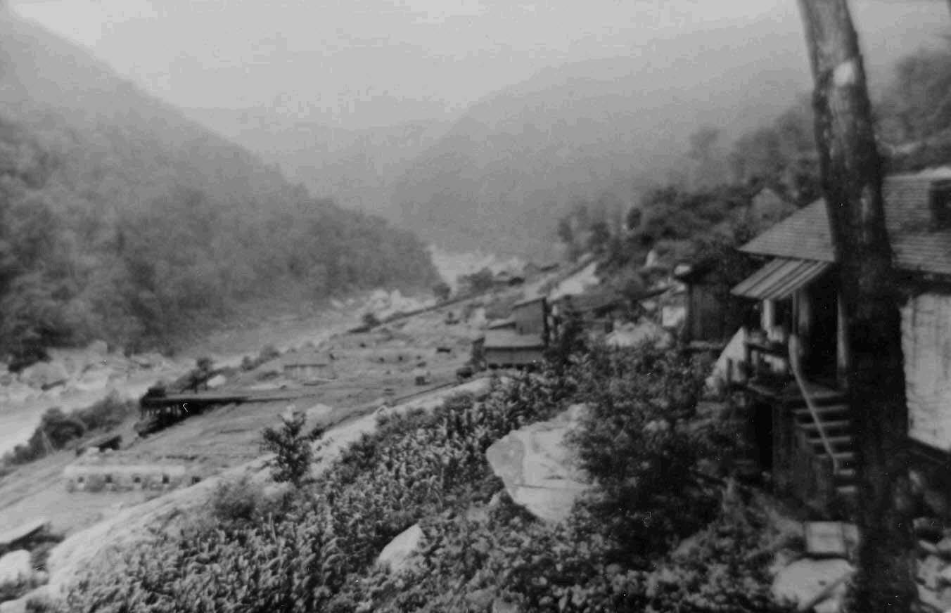
Original Coal Mining Structures
Photograph of original coal mining structures in Nuttallburg circa 1875.
Photograph of original coal mining structures in Nuttallburg circa 1875. Structures included a tipple, the wooden structure with a tower in center of the photograph. Banks of coke ovens were perpendicular to the New
River
Permission must be secured from the individual copyright owners to reproduce any copyrighted materials contained within this website. Digital assets without any copyright restrictions are public domain.
Photograph NERI 315, included as an unnumbered figure in National Park Service (2001b).
Public domain:Full Granting Rights
Image
Bluestone National Scenic River, Code: BLUE
Gauley River National Recreation Area, Code: GARI
New River Gorge National Park and Preserve, Code: NERI
Gauley River National Recreation Area, Code: GARI
New River Gorge National Park and Preserve, Code: NERI
Bluestone National Scenic River, West Virginia
Latitude: 37.5690498352051, Longitude: -80.983757019043
Gauley River National Recreation Area, West Virginia
Latitude: 38.2069396972656, Longitude: -81.0023803710938
New River Gorge National Park and Preserve, West Virginia
Latitude: 37.840259552002, Longitude: -80.9897079467773
Latitude: 37.5690498352051, Longitude: -80.983757019043
Gauley River National Recreation Area, West Virginia
Latitude: 38.2069396972656, Longitude: -81.0023803710938
New River Gorge National Park and Preserve, West Virginia
Latitude: 37.840259552002, Longitude: -80.9897079467773
01/01/0001
Public Can View
Thursday, August 5, 2021 1:16:35 PM
Thursday, August 5, 2021 2:53:23 PM
08_NERI_View_Nuttalburg_Coal_Mining_Complex_and_Town_NERI_315.jpg
Monday, January 1, 0001 12:00:00 AM
jpg
73.6 kB
Scenic