Select Item below to DOWNLOAD - Once item is selected, right click and choose 'save as'
bfbdbf39-9ca5-4bae-abc5-c715ed56eae5
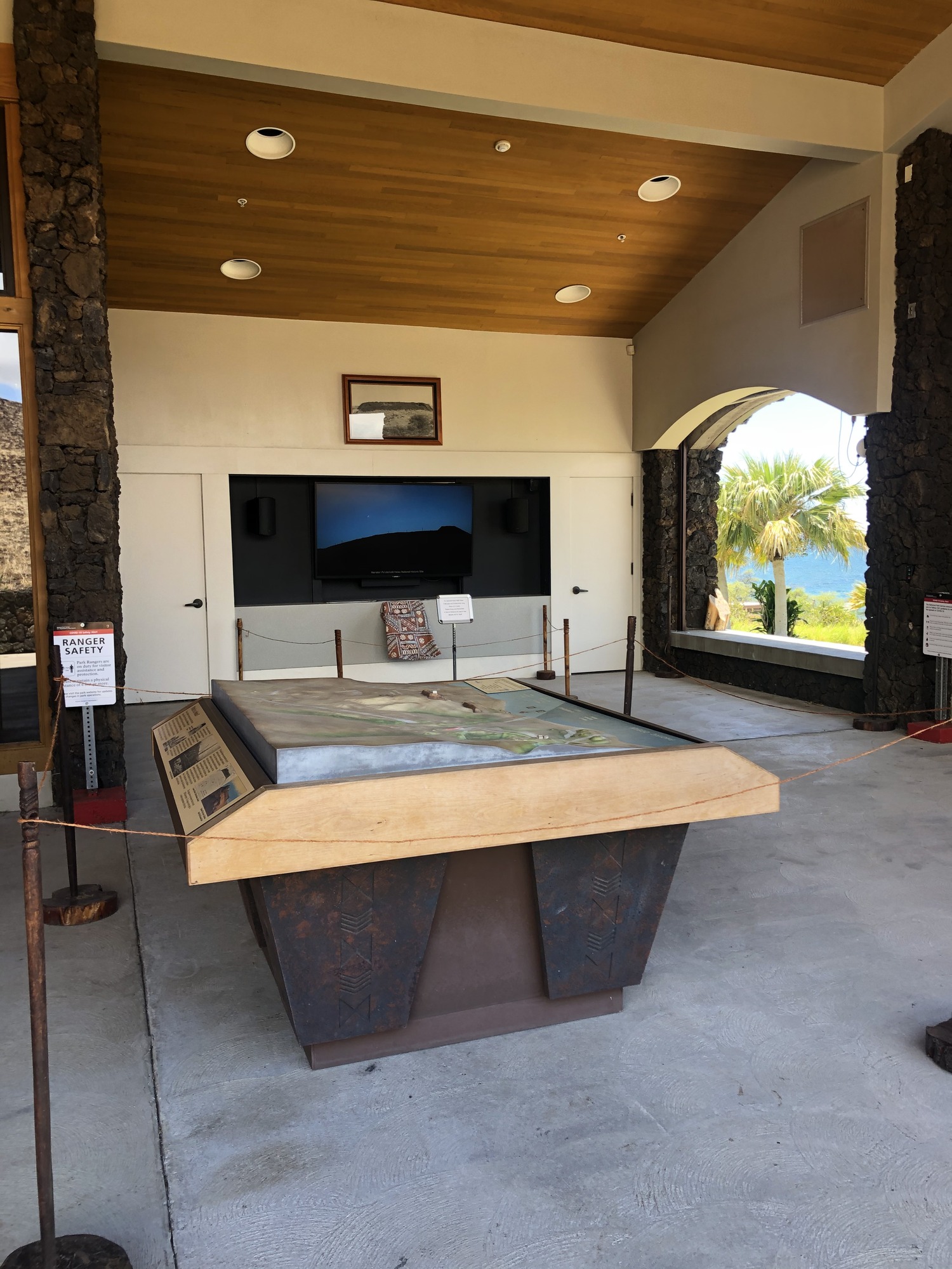
Topographic Map and Park Video
Open covered lanai area.
Five and a half minute park looping video to play daily. Topographic map on display within park boundaries from mountain to sea.
Permission must be secured from the individual copyright owners to reproduce any copyrighted materials contained within this website. Digital assets without any copyright restrictions are public domain.
NPS/M.Tadio
Public domain:Full Granting Rights
Image
Puukohola Heiau National Historic Site, Code: PUHE
Puukohola Heiau National Historic Site, Hawaii County, Hawaii
Latitude: 20.0277004241943, Longitude: -155.820999145508
Latitude: 20.0277004241943, Longitude: -155.820999145508
01/01/2020
08/15/2020
Public Can View
Thursday, August 27, 2020 2:20:37 PM
Thursday, August 27, 2020 2:20:37 PM
IMG_9021.JPG
Apple Apple, iPhone 8 Plus 20, iPhone 8 Plus back dual camera 3.99mm f/1.8
1/133 sec at f / 1.8
3.99 mm
ISO 20
Saturday, August 15, 2020 7:07:37 PM
jpg
2.9 MB
Scenic