Select Item below to DOWNLOAD - Once item is selected, right click and choose 'save as'
be20bbbe-c21a-4965-8cb3-96ab6bde6946
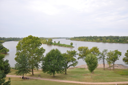
River Confluence
Two periwinkle rivers flow together, framed by bright green trees. In the foreground, the paved River Loop Trail winds through the grass.
The confluence of the Arkansas and Poteau Rivers can be seen from the River Loop Trail.
Permission must be secured from the individual copyright owners to reproduce any copyrighted materials contained within this website. Digital assets without any copyright restrictions are public domain.
NPS Photo
Public domain:Full Granting Rights
Image
Fort Smith National Historic Site, Code: FOSM
Fort Smith National Historic Site, Sebastian County, Arkansas
Latitude: 35.3883018493652, Longitude: -94.4312973022461
Latitude: 35.3883018493652, Longitude: -94.4312973022461
08/14/2013
08/14/2013
Public Can View
Friday, July 12, 2024 8:55:12 PM
Thursday, December 19, 2024 8:09:00 PM
river from above.JPG
NIKON CORPORATION NIKON CORPORATION, NIKON D90
10/3200 sec at f / 5.6
18 mm
ISO 320
Wednesday, August 14, 2013 8:37:14 AM
jpg
3.2 MB
Scenic