Select Item below to DOWNLOAD - Once item is selected, right click and choose 'save as'
bda2b713-baf7-4131-82b1-4e1cef823a48
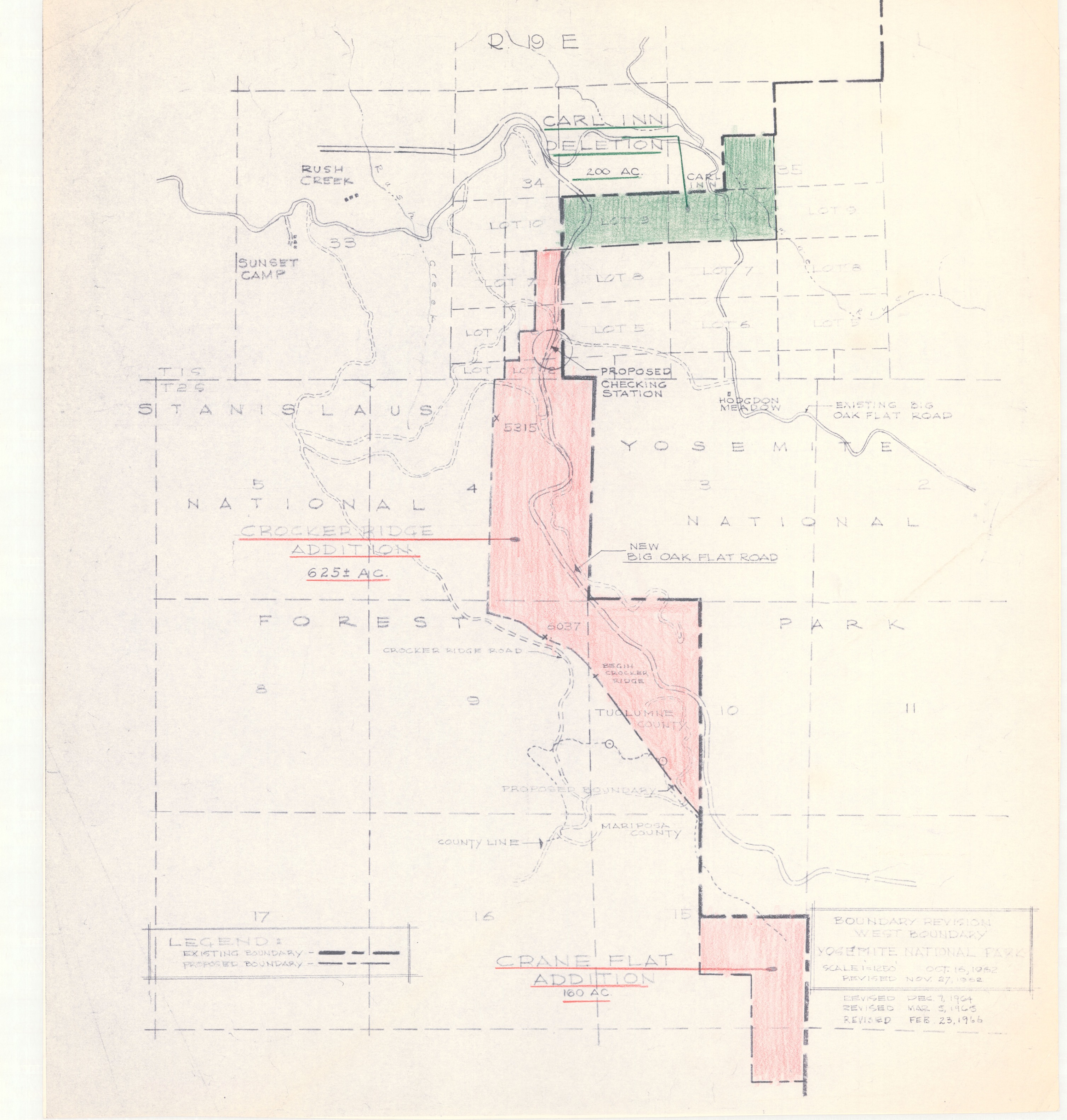
Boundary Revision West Boundary
Boundary Revision West Boundary
Layout of land plots and boundry lines [revised 1964, 1965, 1966], with colored pencil and notes
Item Number: YOSEAR001588, AlternateId: 02-B-023.01
Contact Yosemite National Park for more copyright information and use
Public domain:This digital asset is in the public domain. When using this asset for any purpose, including online, credit:'Courtesy U.S. National Parks'
Image
Yosemite National Park, Code: YOSE
Yosemite National Park, California
Yosemite National Park, California
Latitude: 37.8399200439453, Longitude: -119.540397644043
Yosemite National Park, California
Latitude: 37.8399200439453, Longitude: -119.540397644043
1962
01/01/1962 - 12/30/1962
Type:paper, Dimensions: 21 x 19, Condition: good
YOSE Location: E4 DR7 F3
Public Can View
Person: Archivist
Organization: US National Park Service
Address: Yosemite National Park Archives, PO Box 700-W, El Portal, CA 95318
Email: yose_archives@nps.gov
Organization: US National Park Service
Address: Yosemite National Park Archives, PO Box 700-W, El Portal, CA 95318
Email: yose_archives@nps.gov
Friday, August 4, 2023 3:52:24 PM
Friday, August 4, 2023 3:52:24 PM
YOSEAR001588.tif
tif
458.2 MB
Historic
,
Map