Select Item below to DOWNLOAD - Once item is selected, right click and choose 'save as'
bd3392be-f9b7-479b-8f89-0bfca46641bc
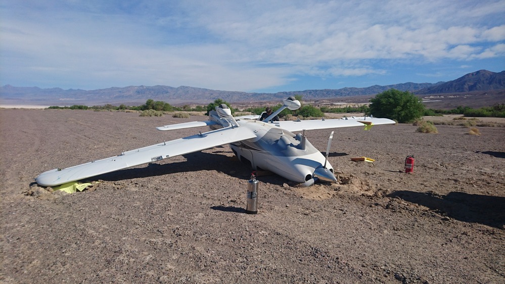
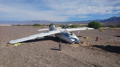
PMIS 315595 Furnace Creek Airport, plane flip 3-24-2017
A Cessna flipped while landing at Furnace Creek Airport March 24, 2017.
Permission must be secured from the individual copyright owners to reproduce any copyrighted materials contained within this website. Digital assets without any copyright restrictions are public domain.
Public domain
Image
Death Valley National Park, Code: DEVA
Latitude: 36.4647672222222, Longitude: -116.881623888889, Elevation: 89
Death Valley National Park
Latitude: 36.5675506591797, Longitude: -117.138999938965
Death Valley National Park
Latitude: 36.5675506591797, Longitude: -117.138999938965
PMIS (Project Management Information System) : 315595
03/24/2017
03/24/2017
Public Can View
Friday, December 17, 2021 10:31:49 AM
Friday, December 17, 2021 10:31:49 AM
March24_FurnaceCreekPlane_NPSPhoto.JPG
Sony Sony, E5803
10/32000 sec at f / 2
4.23 mm
ISO 40
Friday, March 24, 2017 4:14:25 PM
jpg
2.3 MB