Select Item below to DOWNLOAD - Once item is selected, right click and choose 'save as'
b6775f83229e478b9dddd9939918236d
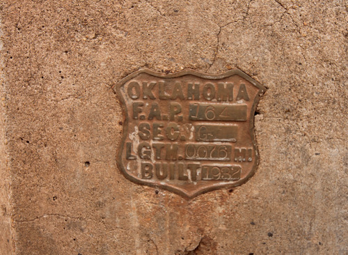
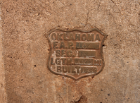
Steel bridge on unnamed creek .7 miles E. of Spur 281 on the 1933 bypass route.
Steel bridge on unnamed creek .7 miles E. of Spur 281 on the 1933 bypass route.
Steel Beam with Concrete guardrails and brass FAP shield embedded in each end; Open to traffic
U.S. National Park Service
IN COPYRIGHT. This Item is protected by copyright and/or related rights. Copyright: Ross, Jim
Jim Ross
Restrictions apply on use and/or reproduction:Copyrighted material
Image
Route 66 Corridor Preservation Program, Code: ROSI
Canadian County, Oklahoma
Latitude: 35.536585, Longitude: -98.221043
Latitude: 35.536585, Longitude: -98.221043
20130329
01/01/1932
Public Can View
Organization: National Trails, US National Park Service
Address: Route 66 Corridor Preservation Program, PO Box 728 Santa Fe, NM 87505, Phone: (505) 988-6701
Email: IM_RT66@nps.gov
Address: Route 66 Corridor Preservation Program, PO Box 728 Santa Fe, NM 87505, Phone: (505) 988-6701
Email: IM_RT66@nps.gov
Thursday, May 28, 2020 8:07:57 AM
Thursday, May 28, 2020 8:07:57 AM
154-IMG_0151OK.jpg
jpg
9.8 MB
Inventory