Select Item below to DOWNLOAD - Once item is selected, right click and choose 'save as'
b43f13d8-8189-4c02-96b5-34661ef8d90a
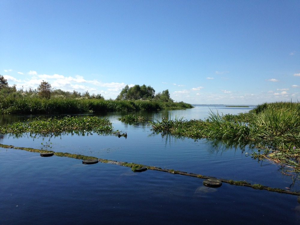
Photograph of the eastern shoreline of Lake Salvador
Photographs of the eastern shoreline of Lake Salvador. A bulkhead at the Tenneco canal.
To reduce the risk of breaching between the eroding eastern shoreline of Lake Salvador into the Bayou Segnette Waterway, an earthen dike was built in 1996 and filled to reestablish the marsh. This project
area is generally known as the geo-crib. In the top photograph: The straight Bayou Segnette Waterway is on the left. Lake Salvador is on right. The dike runs down the side of the canal, and the geo-crib is offshore and ties into additional rock-shoreline protection extending out of the frame of the photograph
to the right. In the bottom photograph: A wooden bulkhead at the Tenneco canal originally dead-ended at a drilling location in the marsh until the lake eroded into it.
Permission must be secured from the individual copyright owners to reproduce any copyrighted materials contained within this website. Digital assets without any copyright restrictions are public domain.
NPS photograph by Courtney Schupp (NPS Geologic Resources Division), taken looking westward into Lake Salvador on 28 October 2015.
Public domain:Full Granting Rights
Image
Jean Lafitte National Historical Park and Preserve, Code: JELA
Jean Lafitte National Historical Park and Preserve, Louisiana
Latitude: 29.8020095825195, Longitude: -90.1701812744141
Latitude: 29.8020095825195, Longitude: -90.1701812744141
10/28/2015
10/28/2015
Public Can View
Monday, June 14, 2021 4:52:56 PM
Monday, June 14, 2021 4:52:56 PM
35_JELA_Oct28_2015_ 116 bayou segnette north _ geocrib to join land.JPG
Apple Apple, iPhone 5c 50, iPhone 5c back camera 4.12mm f/2.4
1/1695 sec at f / 2.4
4.12 mm
ISO 50
Wednesday, October 28, 2015 6:23:08 PM
jpg
2.2 MB
Scenic