Select Item below to DOWNLOAD - Once item is selected, right click and choose 'save as'
b29c4d19-4e3e-4d1e-b038-23019a986861
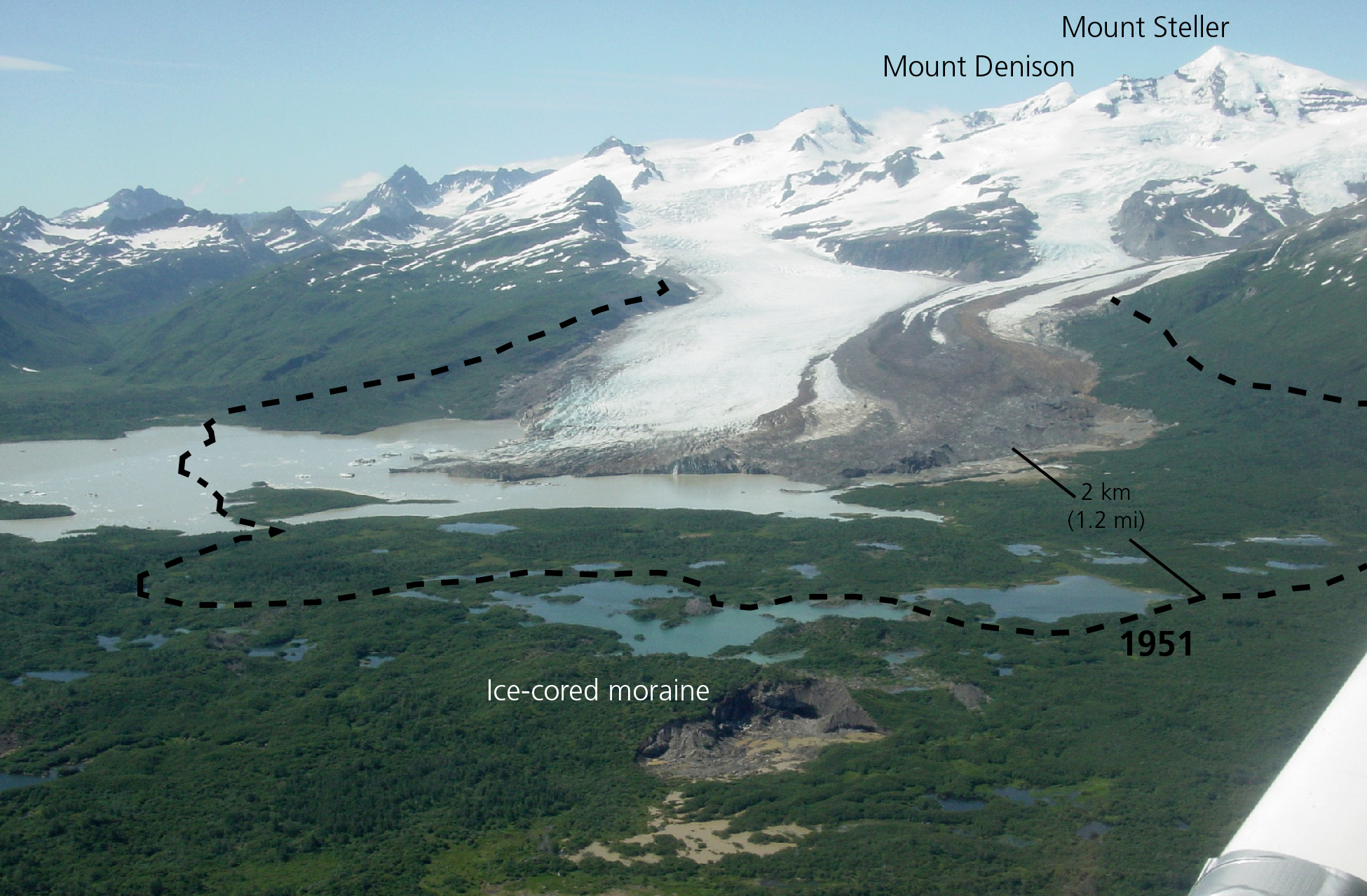
Hallo Glacier
Photograph of Hallo Glacier in 2007.
Photograph of Hallo Glacier in 2007. The approximate extent of the glacier in 1951, based on USGS
topographic map, is shown as a dashed line.
Permission must be secured from the individual copyright owners to reproduce any copyrighted materials contained within this website. Digital assets without any copyright restrictions are public domain.
NPS photograph by Chuck Lindsay
Public domain:Full Granting Rights
Image
Alagnak Wild River, Code: ALAG
Katmai National Park and Preserve, Code: KATM
Katmai National Park and Preserve, Code: KATM
Alagnak Wild River, Lake and Peninsula Borough, Alaska
Latitude: 59.003101348877, Longitude: -156.082000732422
Katmai National Park and Preserve, Alaska
Latitude: 58.5661087036133, Longitude: -154.889404296875
Latitude: 59.003101348877, Longitude: -156.082000732422
Katmai National Park and Preserve, Alaska
Latitude: 58.5661087036133, Longitude: -154.889404296875
01/01/0001
Public Can View
Friday, September 3, 2021 1:16:31 PM
Friday, September 3, 2021 2:15:34 PM
71_KATM_Fig_Hallo Glacier extent modern vs topo-01.jpg
Monday, January 1, 0001 12:00:00 AM
jpg
1.7 MB
Scenic