Select Item below to DOWNLOAD - Once item is selected, right click and choose 'save as'
b2854436-7661-47f6-8e39-dee58d2bbc56
082125 Pisgah Helene Road Status
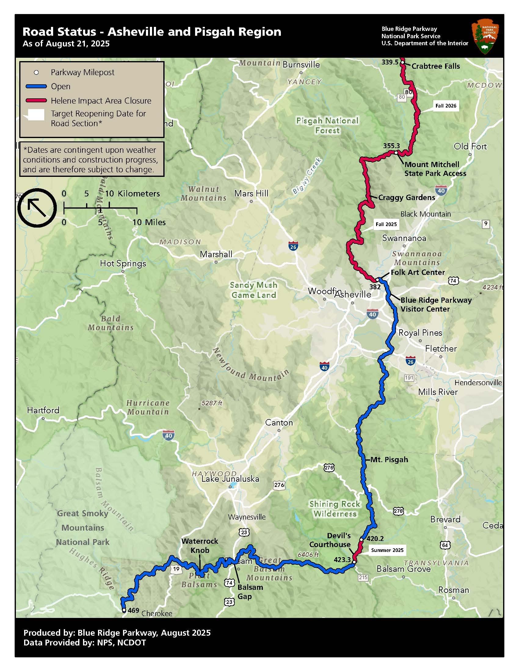
Map showing open and closed sections, detour routes, and target opening dates for construction on the Blue Ridge Parkway in the Pisgah/Asheville region of North Carolina.
Map showing open and closed sections, detour routes, and target opening dates for construction on the Blue Ridge Parkway in the Pisgah/Asheville region of North Carolina.
Permission must be secured from the individual copyright owners to reproduce any copyrighted materials contained within this website. Digital assets without any copyright restrictions are public domain.
NPS Photo
Public domain:Full Granting Rights
Image
Blue Ridge Parkway, Code: BLRI
Blue Ridge Parkway
Latitude: 36.4365005493164, Longitude: -81.070556640625
Latitude: 36.4365005493164, Longitude: -81.070556640625
08/22/2025
01/01/0001
Public Can View
Friday, August 22, 2025 1:47:39 PM
Friday, August 22, 2025 1:54:32 PM
HeleneRoadStatus_Pisgah_20250821.jpg
Monday, January 1, 0001 12:00:00 AM
jpg
353.1 kB
Scenic