Select Item below to DOWNLOAD - Once item is selected, right click and choose 'save as'
b04c5c0e-fe2e-4830-b99b-ef953e9796f0
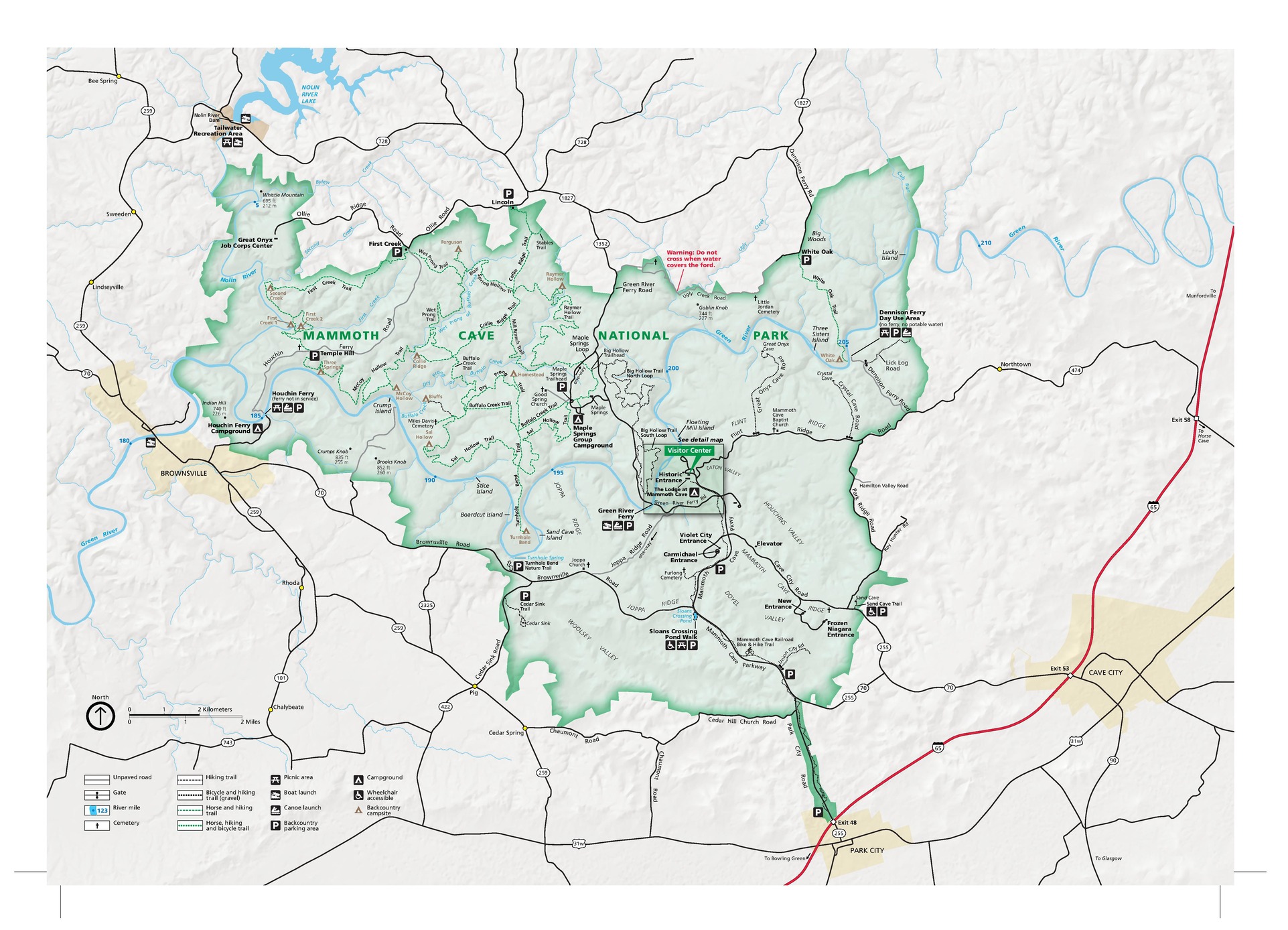
Park Map - Mammoth Cave National Park
Map of Mammoth Cave National Park in Kentucky. The park area is shown in green, surrounding terrain in ivory white, roads mostly in black, and a few towns in yellow.
Screen-viewable file; Adobe print production files can be downloaded from the Compressed zip Version link
Map Projection: WM; Map Type: park map
U.S. National Park Service
The National Park Service maps are government produced and are in the public domain. Anyone may, without restriction under U.S. copyright laws: Reproduce the work in print or digital form; Create derivative works; Perform the work publicly; Display the work; Distribute copies or digitally transfer the work to the public by sale or other transfer of ownership, or by rental, lease, or lending. Please note, a user who modifies and/or republishes National Park Service maps are responsible for any problems encountered with the maps, due to their change or modification.
Public domain
Document
Mammoth Cave National Park, Code: MACA
Mammoth Cave National Park, Kentucky
Latitude: 37.131649017334, Longitude: -86.1454315185547
Latitude: 37.131649017334, Longitude: -86.1454315185547
2018-06-19
Public Can View
Person: Harpers Ferry Center
Organization: US National Park Service
Address: Harpers Ferry Center, Harpers Ferry, WV
Email: HFC_Cartography@nps.gov
Organization: US National Park Service
Address: Harpers Ferry Center, Harpers Ferry, WV
Email: HFC_Cartography@nps.gov
Wednesday, April 27, 2022 8:58:49 PM
Friday, September 26, 2025 11:36:27 PM
MACAmap1.pdf
pdf
21.9 MB
Map