Select Item below to DOWNLOAD - Once item is selected, right click and choose 'save as'
a3c3f25e-7ffd-4f8e-a115-d2fda66d20ad
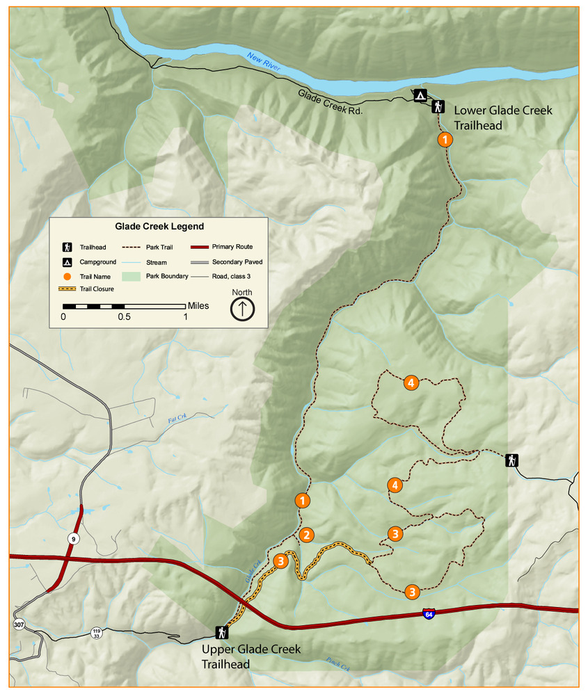
Glade Creek Trails
A map showing the trails in the Glade Creek Area of the park. North is oriented at the top of the map.
The trails of Glade Creek
Permission must be secured from the individual copyright owners to reproduce any copyrighted materials contained within this website. Digital assets without any copyright restrictions are public domain.
Public domain:Full Granting Rights
Image
New River Gorge National Park and Preserve, Code: NERI
New River Gorge National Park and Preserve, West Virginia
Latitude: 37.840259552002, Longitude: -80.9897079467773
Latitude: 37.840259552002, Longitude: -80.9897079467773
01/01/0001
Public Can View
Sunday, June 26, 2022 2:46:57 PM
Sunday, June 26, 2022 7:39:08 PM
Glade Creek Trails 2022-01.jpg
jpg
929.8 kB
Scenic