Select Item below to DOWNLOAD - Once item is selected, right click and choose 'save as'
a17c4fdf-7b0c-4acc-954b-03e58f6c7d64
Golden Lakes Trailside Camp.jpg
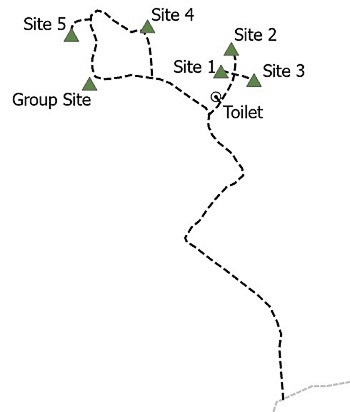
Simple site map of Golden Lakes Trailside Camp showing campsites, trails and other features.
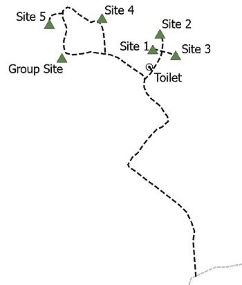
Simple site map of Golden Lakes Trailside Camp showing campsites, trails and other features.
Permission must be secured from the individual copyright owners to reproduce any copyrighted materials contained within this website. Digital assets without any copyright restrictions are public domain.
NPS Graphic
Public domain:Full Granting Rights
Image
Mount Rainier National Park, Code: MORA
Mount Rainier National Park, Washington
Latitude: 46.865608215332, Longitude: -121.682601928711
Latitude: 46.865608215332, Longitude: -121.682601928711
02/01/2021
01/01/0001
Public Can View
Monday, February 8, 2021 11:25:30 AM
Monday, February 8, 2021 11:25:30 AM
Golden Lakes Trailside Camp.jpg
Monday, January 1, 0001 12:00:00 AM
jpg
18.2 kB
Scenic