Select Item below to DOWNLOAD - Once item is selected, right click and choose 'save as'
a05d807376574f65bb30bb34e70bedf7
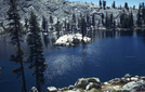
Lower Chain Lake
Lower Chain Lake
A-21-75, Lower Chain Lake, EB, September 1941, Original, A1286, A-16-L-4, Lakes, A-22-018-009
Slide Number: A-22-018-009
U. S. National Park Service
Permission must be secured from the individual copyright owners to reproduce any copyrighted materials contained within this website.
Public domain
Image
Yosemite National Park, Code: YOSE
Lower Chain Lake
Yosemite National Park, California
Latitude: 37.8399200439453, Longitude: -119.540397644043
Yosemite National Park, California
Latitude: 37.8399200439453, Longitude: -119.540397644043
2012/02/25
09/01/1941
Public Can View
Person: Archivist
Organization: US National Park Service
Address: Yosemite National Park Archives, PO Box 700-W, El Portal, CA 95318
Email: yose_archives@nps.gov
Organization: US National Park Service
Address: Yosemite National Park Archives, PO Box 700-W, El Portal, CA 95318
Email: yose_archives@nps.gov
Friday, May 31, 2019 10:22:34 AM
Friday, May 31, 2019 10:22:34 AM
A-22-018-009.jpg
jpg
386.2 kB
Historic