Select Item below to DOWNLOAD - Once item is selected, right click and choose 'save as'
9dfd03f7-b52e-486c-b4f9-6d0e2d7bc280
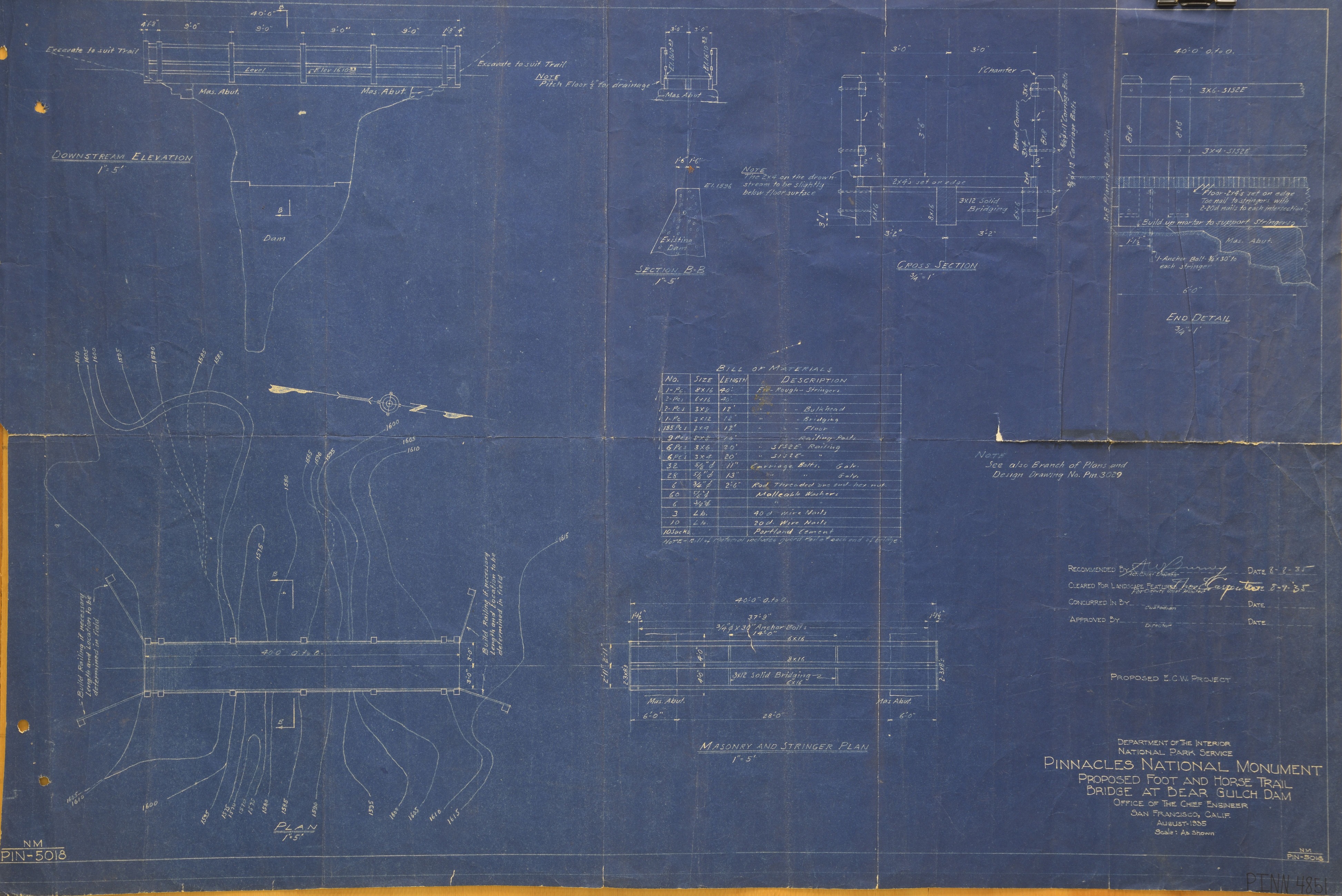
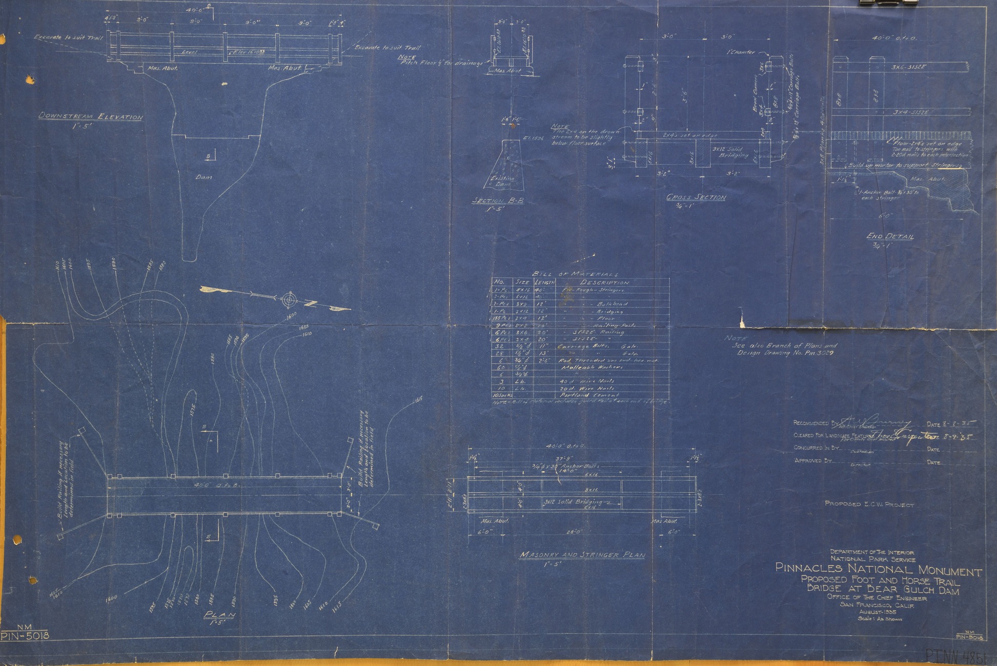
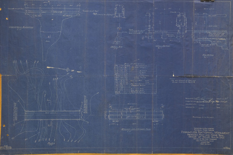
Bear Gulch Dam Blueprint 1935 (Sheet 2 of 2)
Bear Gulch Dam Blueprint 1935 (Sheet 2 of 2)
Bear Gulch Dam Blueprint 1935
This digital asset is in the public domain. When using this asset for any purpose, including online, credit: 'Courtesy U.S. National Parks, Pinnacles National Park'
NPS
Public domain
Document
Pinnacles National Park, Code: PINN
Pinnacles National Park, California
Latitude: 36.4753494262695, Longitude: -121.173400878906
Latitude: 36.4753494262695, Longitude: -121.173400878906
1935
Original ID PINN 4851
Location: FOVA munitions
Public Can View
Organization: Pinnacles National Park
Address: 5000 East Entrance Rd., Paicines, CA 95043, tel: 831-389-4486
Address: 5000 East Entrance Rd., Paicines, CA 95043, tel: 831-389-4486
Monday, May 19, 2025 5:48:33 PM
Monday, May 19, 2025 5:48:33 PM
BG Dam_Bridge_1935b.tif
tif
58.8 MB
Historic