Select Item below to DOWNLOAD - Once item is selected, right click and choose 'save as'
9d6eaa9b-171a-478a-a4e3-7f4595347aa9
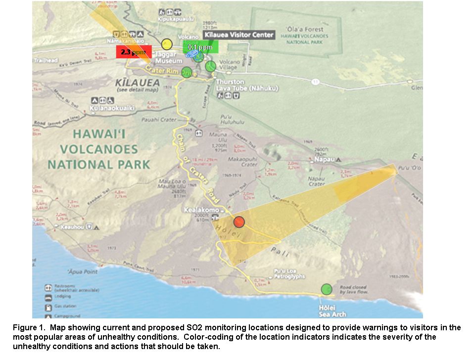
Update SO2 monitoring system at Hawaii Volcanoes NP 2010
Update SO2 monitoring system in Hawaii Volcanoes NP. Map of curren and proposed monitoring stations, photo of VOG plume and Diagram of alert system
Map of curren and proposed monitoring stations,
Permission must be secured from the individual copyright owners to reproduce any copyrighted materials contained within this website. Digital assets without any copyright restrictions are public domain.
Public domain
Image
Hawaii Volcanoes National Park, Code: HAVO
Hawaii Volcanoes NP, Hawaii Volcanoes National Park, Hawaii County, Hawaii
Latitude: 19.3775997161865, Longitude: -155.602996826172
Latitude: 19.3775997161865, Longitude: -155.602996826172
01/01/2010
Public Can View
Tuesday, July 13, 2010 2:17:58 PM
Thursday, August 10, 2017 4:01:13 AM
HAVO-ae5e098424404d628f676df553775d57.tif
Monday, January 1, 0001 12:00:00 AM
tif
954.2 kB
Map
,
Budget