Select Item below to DOWNLOAD - Once item is selected, right click and choose 'save as'
9c391a8f-ea38-4458-8099-c403e91ff1d3
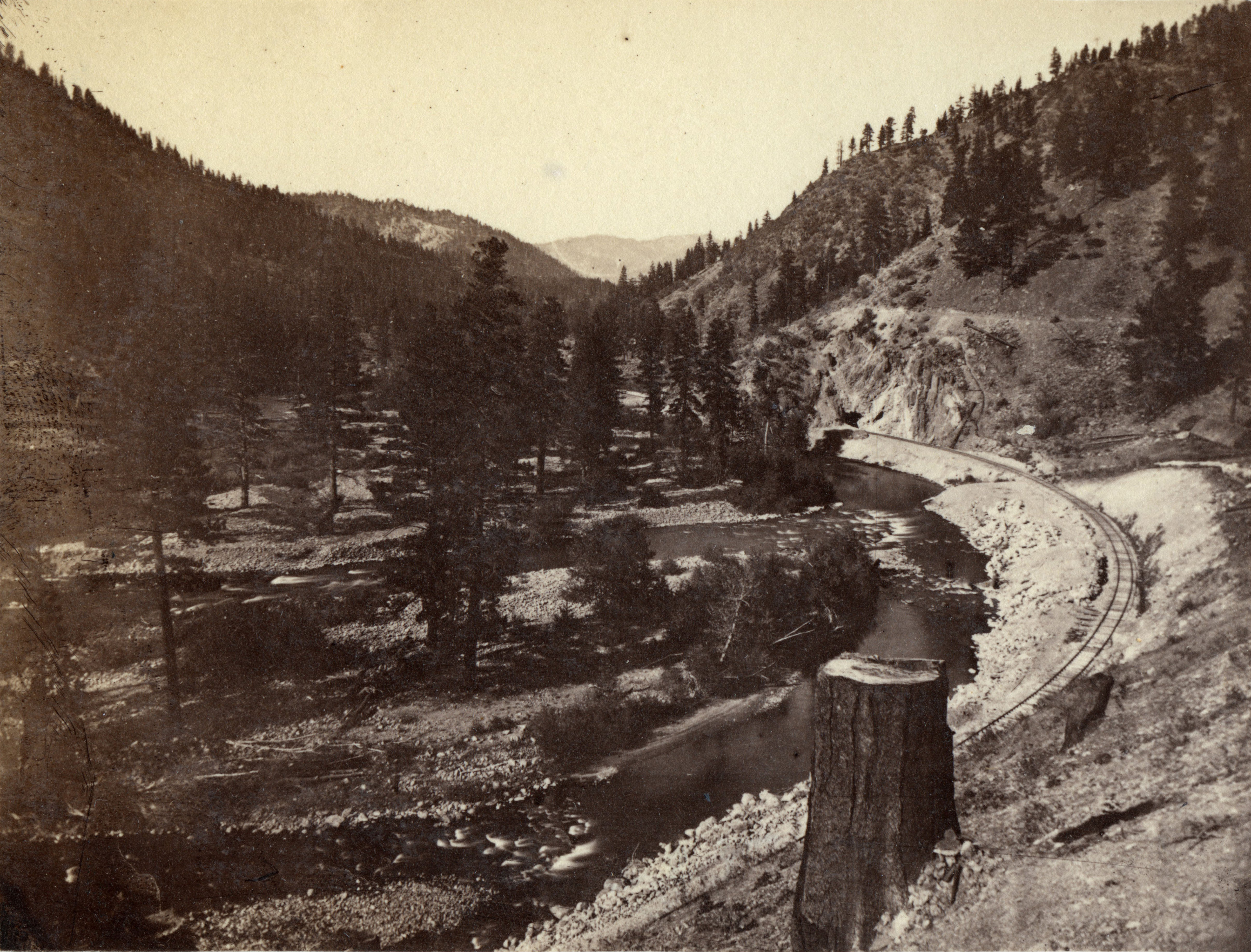
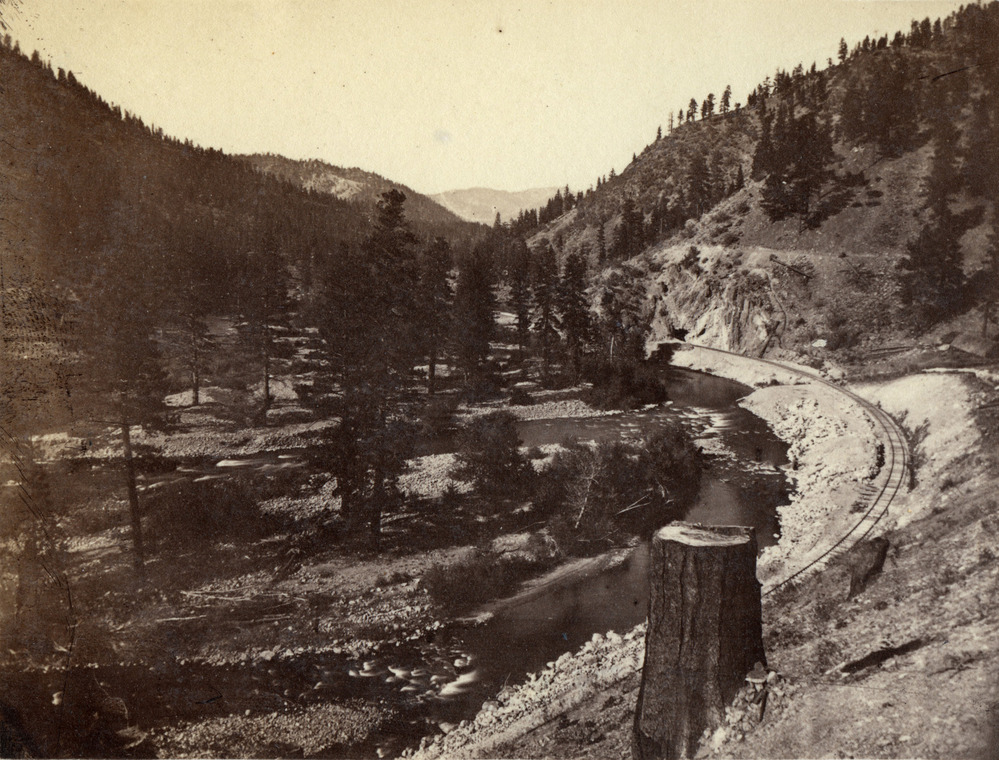
Truckee river entering the Eastern Summit
Truckee river entering the Eastern Summit
Truckee river entering the Eastern Summit
Permission must be secured from the individual copyright owners to reproduce any copyrighted materials contained within this website. Digital assets without any copyright restrictions are public domain.
Public domain:Full Granting Rights
Image
Golden Spike National Historical Park, Code: GOSP
Golden Spike National Historical Park, Box Elder County, Utah
Latitude: 41.6310005187988, Longitude: -112.494003295898
Latitude: 41.6310005187988, Longitude: -112.494003295898
01/01/2001
Public Can View
Friday, June 14, 2019 3:35:11 PM
Friday, June 14, 2019 3:35:11 PM
228 Truckee river entering the Eastern Summit.jpg
Monday, January 1, 0001 12:00:00 AM
jpg
3.0 MB
Scenic