Select Item below to DOWNLOAD - Once item is selected, right click and choose 'save as'
9a3894ef-9c83-4818-aeb5-0a5eb0e0b741
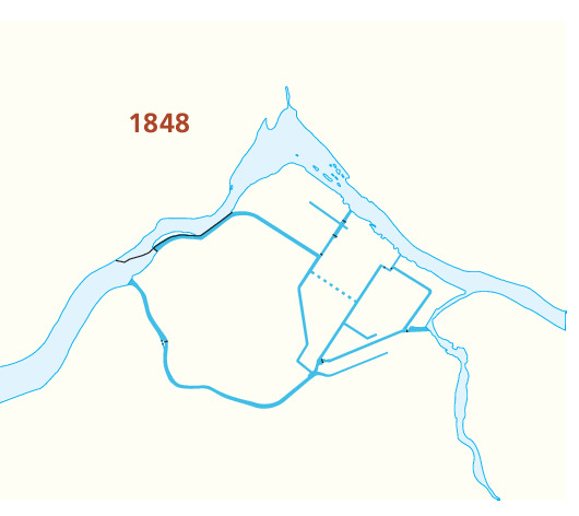
1848 Canal Map - Lowell National Historical Park
Map showing the canal system in Lowell National Historical Park in Massachusetts in 1848. The map is light yellow waterways shown in blue. Small black lines over the canals represent bridges.
Screen-viewable file; Adobe print production files can be downloaded from the Compressed zip Version link
Map Projection: Other; Map Type: unassigned
U.S. National Park Service
The National Park Service maps are government produced and are in the public domain. Anyone may, without restriction under U.S. copyright laws: Reproduce the work in print or digital form; Create derivative works; Perform the work publicly; Display the work; Distribute copies or digitally transfer the work to the public by sale or other transfer of ownership, or by rental, lease, or lending. Please note, a user who modifies and/or republishes National Park Service maps are responsible for any problems encountered with the maps, due to their change or modification.
Public domain
Document
Lowell National Historical Park, Code: LOWE
Lowell National Historical Park, Middlesex County, Massachusetts
Latitude: 42.6464996337891, Longitude: -71.3309020996094
Latitude: 42.6464996337891, Longitude: -71.3309020996094
2015-06-18
Public Can View
Person: Harpers Ferry Center
Organization: US National Park Service
Address: Harpers Ferry Center, Harpers Ferry, WV
Email: HFC_Cartography@nps.gov
Organization: US National Park Service
Address: Harpers Ferry Center, Harpers Ferry, WV
Email: HFC_Cartography@nps.gov
Wednesday, April 27, 2022 7:44:40 PM
Friday, September 26, 2025 11:36:25 PM
LOWEmap4.pdf
pdf
101.5 kB
Map