Select Item below to DOWNLOAD - Once item is selected, right click and choose 'save as'
99A92DA3-9D21-0D4D-171AEE8BAE4FBFA5
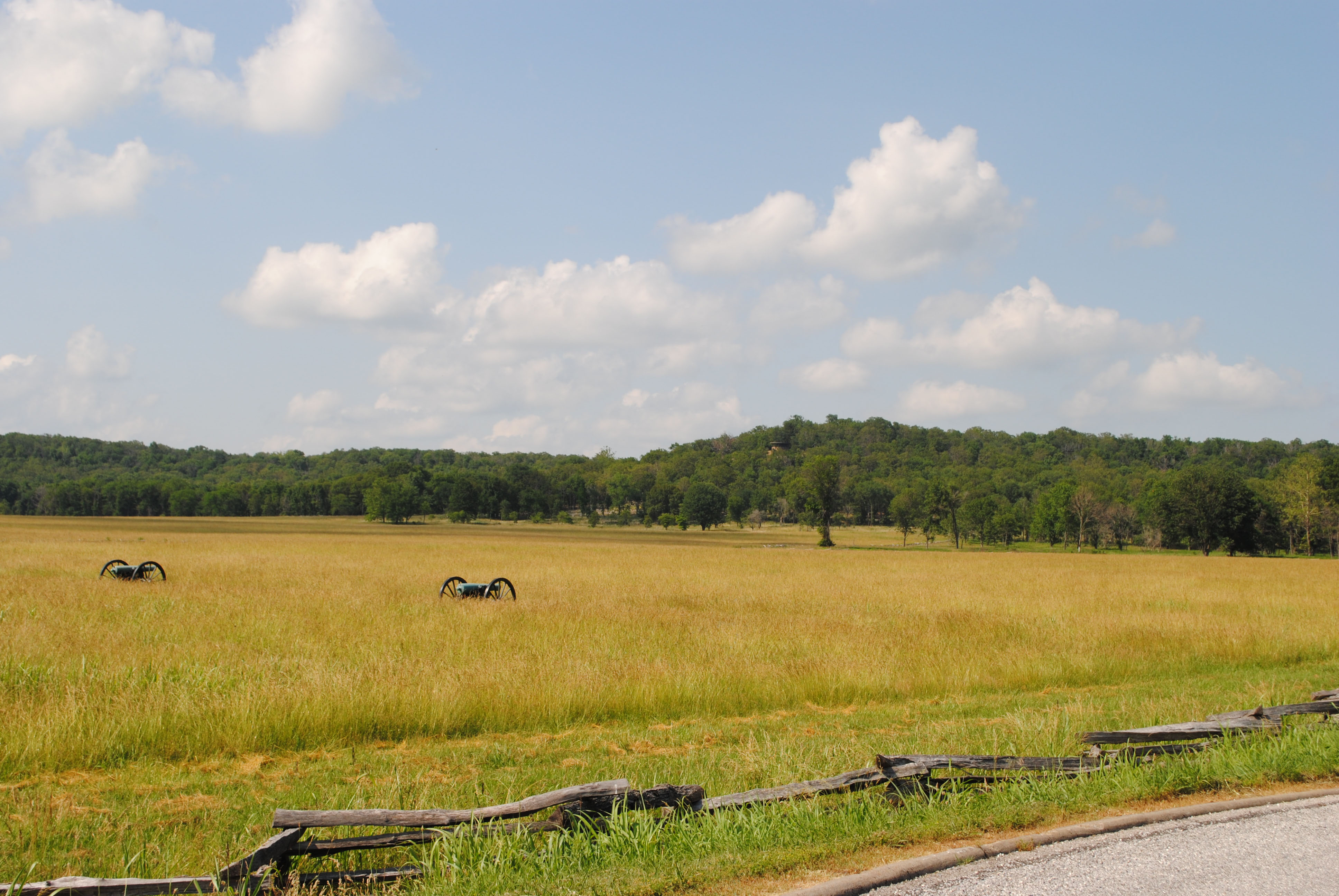
Cox Field towards Elkhorn Mountain
Cox Field towards Elkhorn Mountain at Pea Ridge National Military Park
Pea Ridge National Military Park. Elkhorn Mountain is the highest point in the park, which is situated in the gently rolling foothills of the Ozarks. The Cox family was one of the families residing in this region of Arkansas when the Civil War events of 1862 occurred.
Cox Field was the location of a March 8th artillery confrontation. Union commanders placed guns on a hill in the middle of the field and others across Telegraph Road. From these points, Federal forces assaulted the Confederate batteries. As Southern troops ran out of ammunition and were unable to advance, Union General Sigel moved his guns forward from the hill and inflicted further damage to the infantry concealed beyond the treeline. The resulting Confederate retreat secured a battle victory for the North, but not without significant losses on both sides.
U.S. National Park Service
Permission must be secured from the individual copyright owners to reproduce any copyrighted materials contained within this website. Digital assets without any copyright restrictions are public domain.
NPS Park Cultural Landscapes Program
Public domain:Full Granting Rights
Image
Pea Ridge National Military Park, Code: PERI
Park Cultural Landscapes Program, Code: PCLP
Park Cultural Landscapes Program, Code: PCLP
Latitude: 36.45299, Longitude: -94.01679
Pea Ridge National Military Park, Benton County, Arkansas
Latitude: 36.4547996520996, Longitude: -94.0344009399414
Pea Ridge National Military Park, Benton County, Arkansas
Latitude: 36.4547996520996, Longitude: -94.0344009399414
8/9/2013 3:15:00 PM
Public Can View
Wednesday, September 12, 2018 3:15:18 PM
Wednesday, September 12, 2018 3:15:18 PM
99B85995-0BDB-8876-D505434B777AE518.jpg
Thursday, August 8, 2013 10:03:45 PM
jpg
1.2 MB
Scenic