Select Item below to DOWNLOAD - Once item is selected, right click and choose 'save as'
95f9f6c3-4efd-40ec-b61a-2779b84aa508
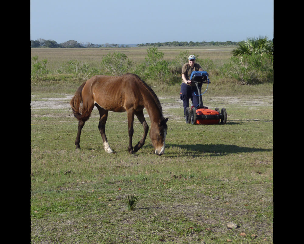
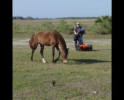
SEAC on the road: GPR survey, Cumberland Island National Seashore
The island's feral horses will stand in the way of science if that's where the grass is best. Trees are a common obstacle to a ground penetrating radar survey, but in the Lower Garden at Dungeness, Jessica McNeil had to deal with one of the horses, which are not friendly and which damage the island's environment.
Permission must be secured from the individual copyright owners to reproduce any copyrighted materials contained within this website. Digital assets without any copyright restrictions are public domain.
Southeast Archeological Center, NPS
Public domain
Image
Southeast Archeological Center, Code: SEAC
06/11/2015
03/28/2012
Public Can View
Person: Jill Halchin
Organization: SEAC
Role: owner
Position: GIS Coordinator
Address: Southeast Archeological Center, NPS
Email: jill_halchin@nps.gov
Organization: SEAC
Role: owner
Position: GIS Coordinator
Address: Southeast Archeological Center, NPS
Email: jill_halchin@nps.gov
Thursday, June 11, 2015 12:13:16 PM
Thursday, August 10, 2017 3:09:13 AM
CUIS_horseGPR.jpg
Panasonic Panasonic, DMC-ZR1
10/3200 sec at f / 5
14.5 mm
ISO 80
Wednesday, March 28, 2012 3:40:36 PM
jpg
206.1 kB