Select Item below to DOWNLOAD - Once item is selected, right click and choose 'save as'
8de58798-966a-4192-9bf1-85f92a359a0d
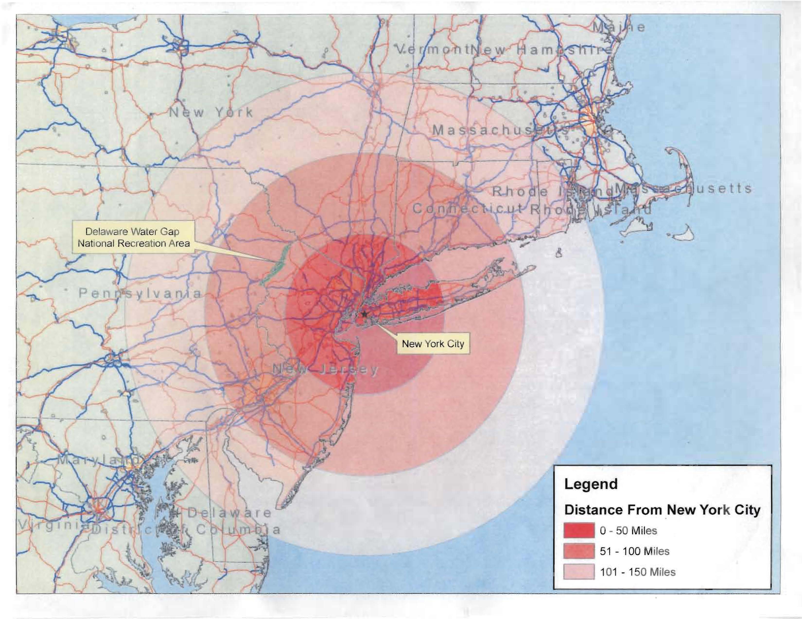
Viscinity of Delaware Water Gap NRA to New York City, New York
This image visually demonstrates the proximity of the two parks (DEWA/MDSR) to New York City, New York.
Pt. 1. Proximity Map
Permission must be secured from the individual copyright owners to reproduce any copyrighted materials contained within this website. Digital assets without any copyright restrictions are public domain.
Public domain:Test record. Not for public display.
Image
Delaware Water Gap National Recreation Area, Code: DEWA
Delaware National Scenic River, Code: DELA
Southeast Archeological Center, Code: SEAC
Delaware National Scenic River, Code: DELA
Southeast Archeological Center, Code: SEAC
Delaware Water Gap National Recreation Area
Latitude: 41.1003189086914, Longitude: -74.9569320678711
Delaware National Scenic River
Latitude: 40.9760284423828, Longitude: -75.1355285644531
Latitude: 41.1003189086914, Longitude: -74.9569320678711
Delaware National Scenic River
Latitude: 40.9760284423828, Longitude: -75.1355285644531
Legacy NPS Focus Record ID : 478073
Image
Public Can View
Friday, June 1, 2012 8:36:45 AM
Thursday, August 10, 2017 2:11:24 AM
DEWA-323a72ebd6a14856b06c6f7083f383b3.jpg
Monday, January 1, 0001 12:00:00 AM
jpg
429.6 kB