Select Item below to DOWNLOAD - Once item is selected, right click and choose 'save as'
886fac557f4345a7bfa68d36393e0b98
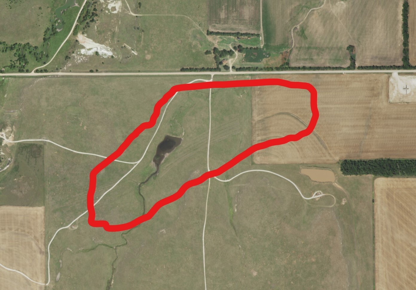
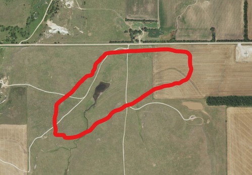
An aerial photo of Fry's Ruts near Windom, KS - 4
A red marked area in the middle of a field.
The Santa Fe Trail – Rice County Segment 2 is one of the remaining examples of the route taken by
Santa Fe Trail traffic heading from the lower crossing of the Little Arkansas River.; https://www.nps.gov/nr/feature/places/pdfs/13000580.pdf
U.S. National Park Service
Permission must be secured from the individual copyright owners to reproduce any copyrighted materials contained within this website.
Public domain
Kansas, (SanteFe Trail State)
Image
Santa Fe National Historic Trail, Code: SAFE
Segment 2 ; Windom ; Fry's Ruts, Rice County, Kansas
Santa Fe National Historic Trail
Latitude: 37.9892997741699, Longitude: -99.3414993286133
Santa Fe National Historic Trail
Latitude: 37.9892997741699, Longitude: -99.3414993286133
20171130
11/30/2017
Shot On: Canon PowerShot SX230 HS; Dimensions 1392 x 970; Size 274.2 KB
Public Can View
Organization: US National Park Service
Address: PO Box 728, Santa Fe, New Mexico 87504, Phone:(505) 988-6098
Email: ntir_information@NPS.gov
Address: PO Box 728, Santa Fe, New Mexico 87504, Phone:(505) 988-6098
Email: ntir_information@NPS.gov
Tuesday, November 3, 2020 3:52:57 PM
Tuesday, November 3, 2020 3:52:57 PM
SAFE_KS_RiceCounty_Segment 2_Windom_Fry's Ruts_AerialImages_20180426_NPS_(04).JPG
jpg
280.8 kB
Scenic
,
Historic