Select Item below to DOWNLOAD - Once item is selected, right click and choose 'save as'
82ea0001-bb37-4525-a49b-e0f1b73d3b0a
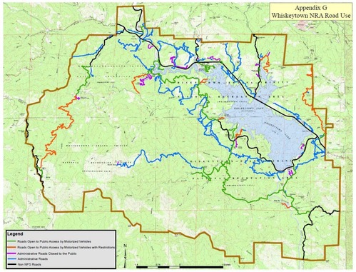
Appendix G: Whiskeytown NRA Road Use
Map with color coded lines that shows which roads are open to Public Access, which are closed, and what roads are non NPS.
Map with color coded lines that shows which roads are open to Public Access, which are closed, and what roads are non NPS.
xr:d:DAF-lBp6RR8:8,j:6246913449449646158,t:24030523
Permission must be secured from the individual copyright owners to reproduce any copyrighted materials contained within this website. Digital assets without any copyright restrictions are public domain.
Public domain:Full Granting Rights
Image
Whiskeytown National Recreation Area, Code: WHIS
Whiskeytown National Recreation Area, Shasta County, California
Latitude: 40.6136016845703, Longitude: -122.601997375488
Latitude: 40.6136016845703, Longitude: -122.601997375488
01/01/0001
Public Can View
Tuesday, March 5, 2024 11:49:30 PM
Wednesday, March 6, 2024 12:06:08 AM
10.jpg
Monday, January 1, 0001 12:00:00 AM
jpg
527.1 kB
Scenic