Select Item below to DOWNLOAD - Once item is selected, right click and choose 'save as'
7878b94d-aa7f-4105-aae7-b7051b6e7a45
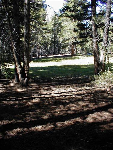
Proposed demonstration stock camp at Lower Rock Creek Xing, Sequoia and Kings Canyon National Park
Between July and September 2003 the Stock Use and Meadow Monitoring Program at Sequoia and Kings Canyon National Parks conducted an environmental assessment of a number of wilderness meadows within the boundaries of the two parks. The image(s) included here are part of the digital image record created as part of those surveys.
U.S. National Park Service
Ranger Station: Rock Creek || Zone and meadow: 84-2
Permission must be secured from the individual copyright owners to reproduce any copyrighted materials contained within this website. Digital assets without any copyright restrictions are public domain.
Public domain
Image
Sequoia and Kings Canyon National Parks, Code: SEKI
Lower Rock Creek Crossing, Sequoia and Kings Canyon National Parks, California
Latitude: 36.7172584533691, Longitude: -118.537902832031
Latitude: 36.7172584533691, Longitude: -118.537902832031
Legacy NPS Focus Record ID : 231613
08/01/2003 | 2003/08/
08/01/2003
Public Can View
Wednesday, September 29, 2004 6:26:13 PM
Thursday, August 10, 2017 12:01:35 AM
mdw84-2_2003015.jpg
Monday, January 1, 0001 12:00:00 AM
jpg
270.7 kB
Scenic
Proposed demonstration stock camp at Lower Rock Creek Xing, Sequoia and Kings Canyon National Park
Proposed demonstration stock camp at Lower Rock Creek Xing, Sequoia and Kings Canyon National Park
Proposed demonstration stock camp at Lower Rock Creek Xing, Sequoia and Kings Canyon National Park
Proposed demonstration stock camp at Lower Rock Creek Xing, Sequoia and Kings Canyon National Park
Proposed demonstration stock camp at Lower Rock Creek Xing, Sequoia and Kings Canyon National Park