Select Item below to DOWNLOAD - Once item is selected, right click and choose 'save as'
776561a2-69ba-454d-827f-e13901836ddc
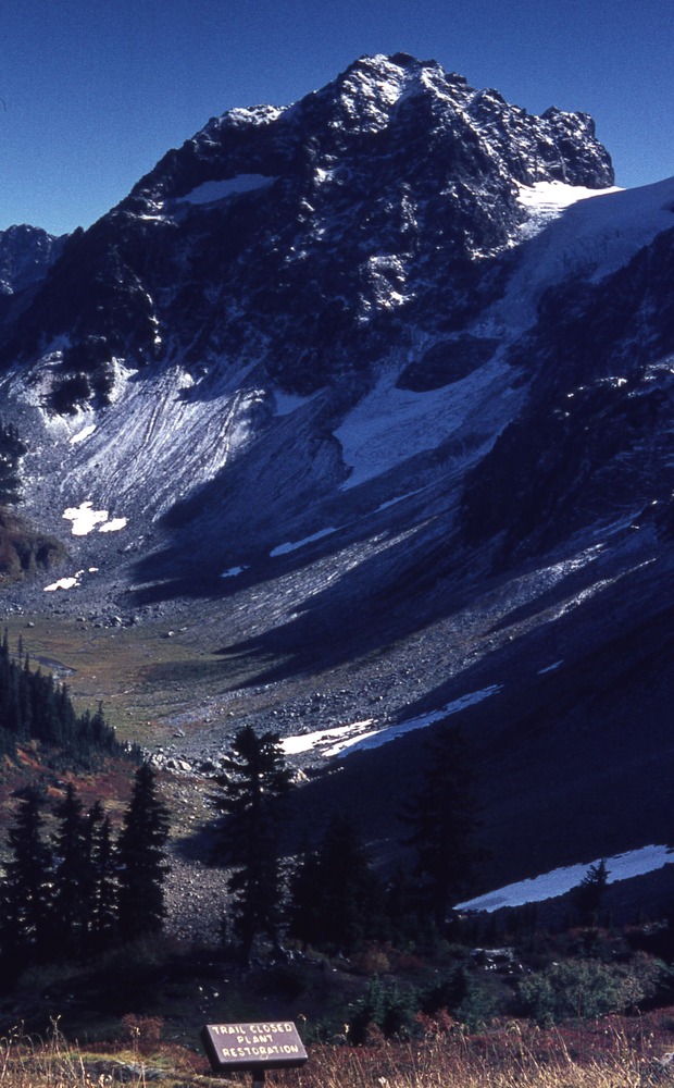
View from Cascade Pass site TH14, 9/13/1970, 2 of 3
A rocky basin of snow and rock. In the distance is a blunted peak and in the foreground is a forested area with a dirt clearing. In the extreme foreground is a sign that reads "trail closed, plant restoration."
Cascade Pass, Revegetation Site TH14, revegetation monitoring photograph. Text on slide frame reads: "REV/CAS/TH14/a-2, Cascade Pass, Joseph W. Miller, 9-13-70." (North Cascades NPS Complex Museum Collection, NOCA.0013 Revegetation Program Records, Series XI: Photographs, File 001 - Cascade Pass Vicinity Impacts and Revegetation Sites, 1970-2004)
U.S. National Park Service
This digital asset is in the public domain. When using this asset for any purpose, including online, credit: 'Courtesy of North Cascades NPS Complex Museum Collection, Revegetation Program Records.'
NPS Photo
Public domain
Native Plant Restoration, (North Cascades Program)
, Cascade Pass, (North Cascades Locality)
, Revegetation, (North Cascades Activity)
, Cascade Pass, (North Cascades Locality)
, Revegetation, (North Cascades Activity)
Image
North Cascades National Park, Code: NOCA
North Cascades National Park, Washington
Latitude: 48.8278884887695, Longitude: -121.35050201416
Cascade Pass
Latitude: 48.8278884887695, Longitude: -121.35050201416
Cascade Pass
ICMS Archives Module : NOCA.0013.11.001
2024/02/12
09/13/1970
slide transparency
Curation Facility
Public Can View
Person: NOCA Curator
Organization: North Cascades NPS Complex
Position: Museum Curator
Address: 7280 Ranger Station Road, Marblemount, WA 98267
Email: NOCA_Curator@nps.gov.
Organization: North Cascades NPS Complex
Position: Museum Curator
Address: 7280 Ranger Station Road, Marblemount, WA 98267
Email: NOCA_Curator@nps.gov.
Thursday, January 30, 2025 5:14:01 PM
Thursday, January 30, 2025 5:14:01 PM
0013.11.001.0634.tif
tif
34.7 MB
Monitoring