Select Item below to DOWNLOAD - Once item is selected, right click and choose 'save as'
75930e3a-80b2-451d-9737-bc4fe2ae5d4d
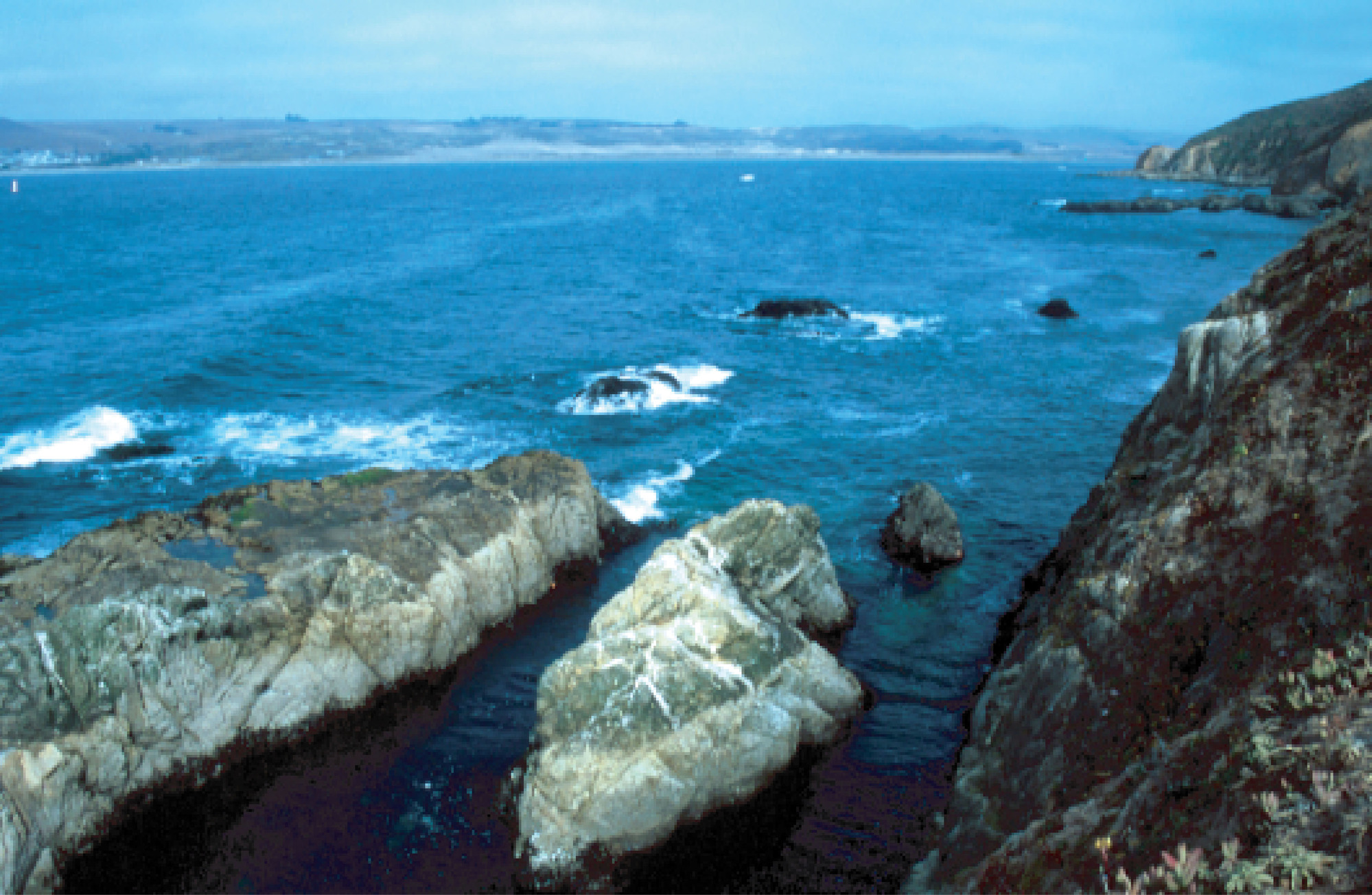
San Andreas Fault—Tomales Bay (Labeled)
rocky shoreline and open water bay
Point Reyes National Seashore, California. Tomales Bay is the surface expression of the San Andreas Fault. The granite rocks in the foreground are similar to those found in Yosemite National Park in the Sierra Nevada Mountains. They have been transported about 300 miles (500 kilometers) in a north-northwestward direction along the transform plate boundary. The sedimentary and metamorphic rocks across the fault line are similar to those found in Redwood National and State Parks on the North Coast of California. They were lifted out of the ocean as part of the accretionary wedge of an ancient subduction zone.
Permission must be secured from the individual copyright owners to reproduce any copyrighted materials contained within this website. Digital assets without any copyright restrictions are public domain.
Photo Courtesy of Robert J. Lillie.
Public domain:Full Granting Rights
Image
Geologic Resources Division, Code: GRD
[date?]
11/20/2019
Public Can View
Friday, January 31, 2020 9:36:24 AM
Friday, January 31, 2020 9:36:24 AM
PORE tomales bay@10x.jpg
Thursday, November 21, 2019 12:05:11 AM
jpg
1.1 MB
Scenic