Select Item below to DOWNLOAD - Once item is selected, right click and choose 'save as'
70EB0A0C-CB42-3A2C-BEAD8A2A2138F106
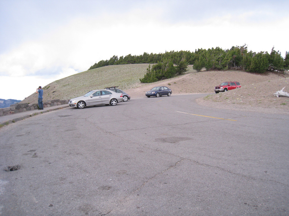
Cloudcap Observation Station
A visitor looks over a low stone wall, built alongside a walkway and curving parking area.
Rim Drive Historic District. Cloudcap is the highest point along Rim Drive, the observation station located at the terminus of a spur road that diverges from the main circuit. It ends in a one-way loop that passes along a parapet with masonry guardrail and a raised walk, like other parking overlooks. However, this one differs in having an oval shape and a sloping area, intended to facilitate the flow of vehicles and protect a stand of plantings.
U.S. National Park Service
Permission must be secured from the individual copyright owners to reproduce any copyrighted materials contained within this website. Digital assets without any copyright restrictions are public domain.
NPS Photo, Germano, 2010
Public domain:Full Granting Rights
Image
Crater Lake National Park, Code: CRLA
42.93212, -122.05326
Crater Lake National Park, Oregon
Latitude: 42.9442710876465, Longitude: -122.135299682617
Crater Lake National Park, Oregon
Latitude: 42.9442710876465, Longitude: -122.135299682617
Public Can View
Wednesday, September 12, 2018 1:00:18 PM
Wednesday, September 12, 2018 1:00:18 PM
70EB0EF8-C2E6-DB67-01EBFDEADB3D385A.jpg
Canon Canon, Canon PowerShot SD870 IS
1/1250 sec at f / 2.8
4.6 mm
ISO 200
Tuesday, July 27, 2010 8:59:54 PM
jpg
317.9 kB
Scenic