Select Item below to DOWNLOAD - Once item is selected, right click and choose 'save as'
6e7547d8-fe50-4ac0-a217-3f2ab4397a93
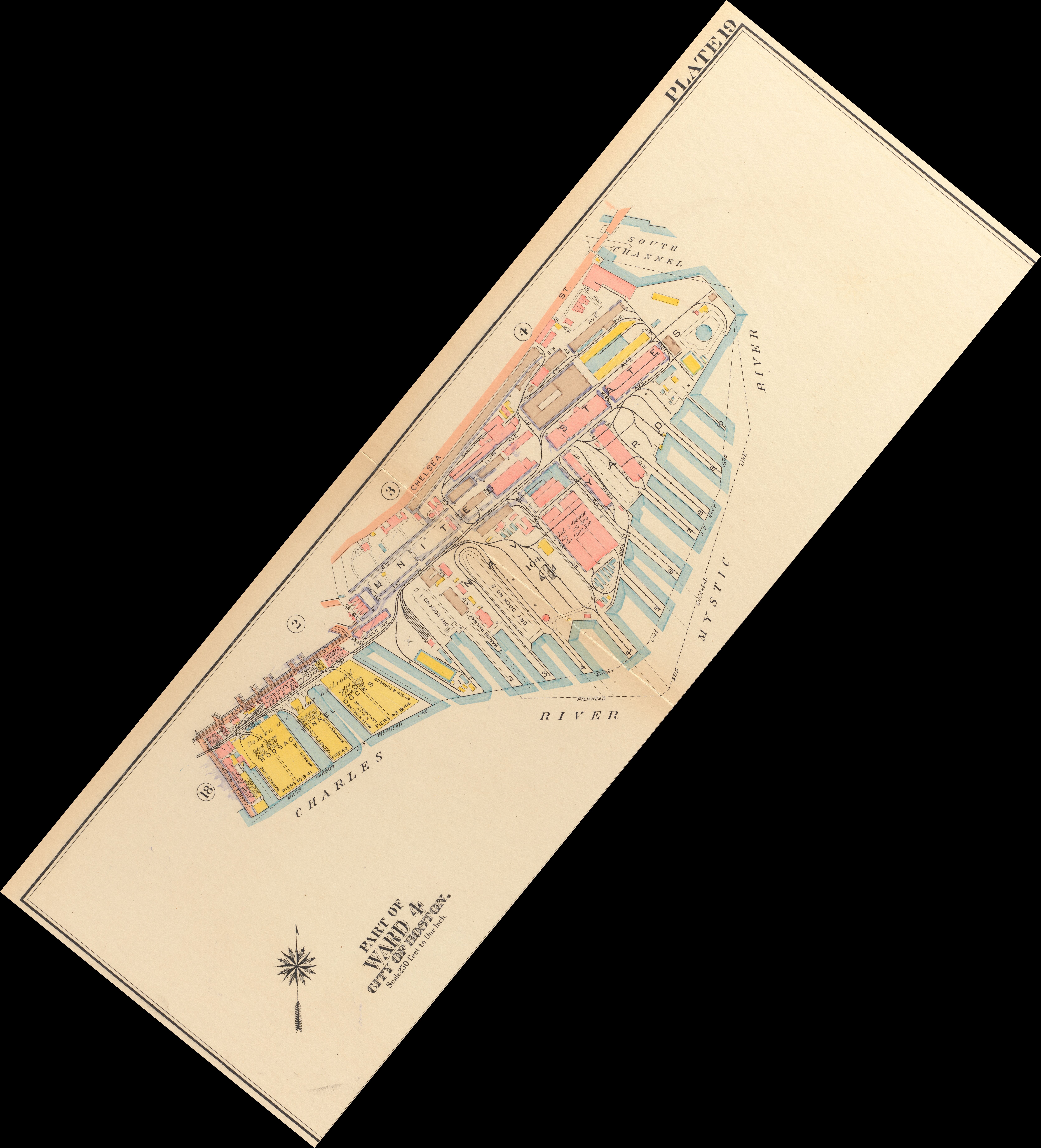
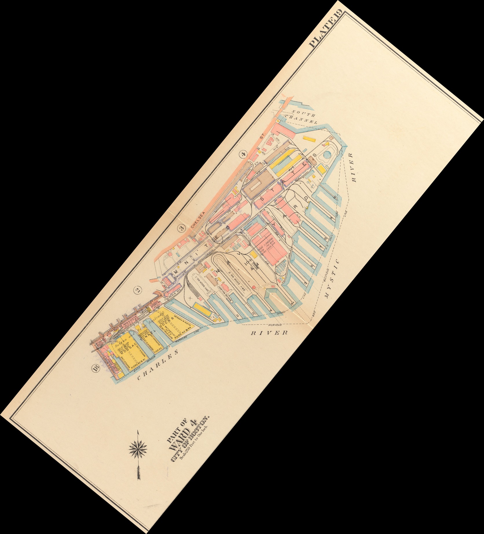
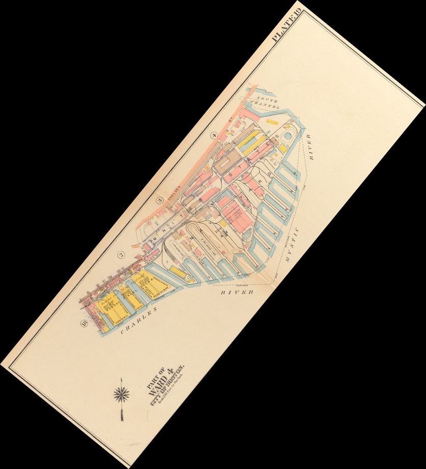
Atlas of the city of Boston, Charlestown and East Boston, 1922, Plate 19 - Crop of upper portion of plate depicting Charlestown waterfront
Yellowed print depicting waterfront piers with blue outlines and building outlines with yellow or red shading. Title reads in upper right "Plate 19" and has a title of "Part of Ward 4 City of Boston"
Crop of upper half of plate 19 from the 1922 Bromley atlas of the City of Boston
Public domain, however access was courtesy of the Norman B. Leventhal Map Center at the Boston Public Library
Norman B. Leventhal Map Center at the Boston Public Library
Public domain:Full Granting Rights
Image
Boston National Historical Park, Code: BOST
Boston National Historical Park, Suffolk County, Massachusetts
Latitude: 42.3734016418457, Longitude: -71.0557022094727
Latitude: 42.3734016418457, Longitude: -71.0557022094727
https://www.digitalcommonwealth.org/search/commonwealth:1257c121h
08/30/2022
01/01/1922
Public Can View
Person: Eric Hanson Plass
Organization: National Park Service
Position: Visual Information Specialist
Address: 21 Second Ave
Email: eric_hanson_plass@nps.gov
Organization: National Park Service
Position: Visual Information Specialist
Address: 21 Second Ave
Email: eric_hanson_plass@nps.gov
Wednesday, August 31, 2022 2:33:13 AM
Wednesday, August 31, 2022 4:07:29 AM
commonwealth_1257c121h_image_primary.geotiff.tif
tif
148.2 MB
Map