Select Item below to DOWNLOAD - Once item is selected, right click and choose 'save as'
6cb78282-1f0b-4d0a-8df1-4d522ccda7fe
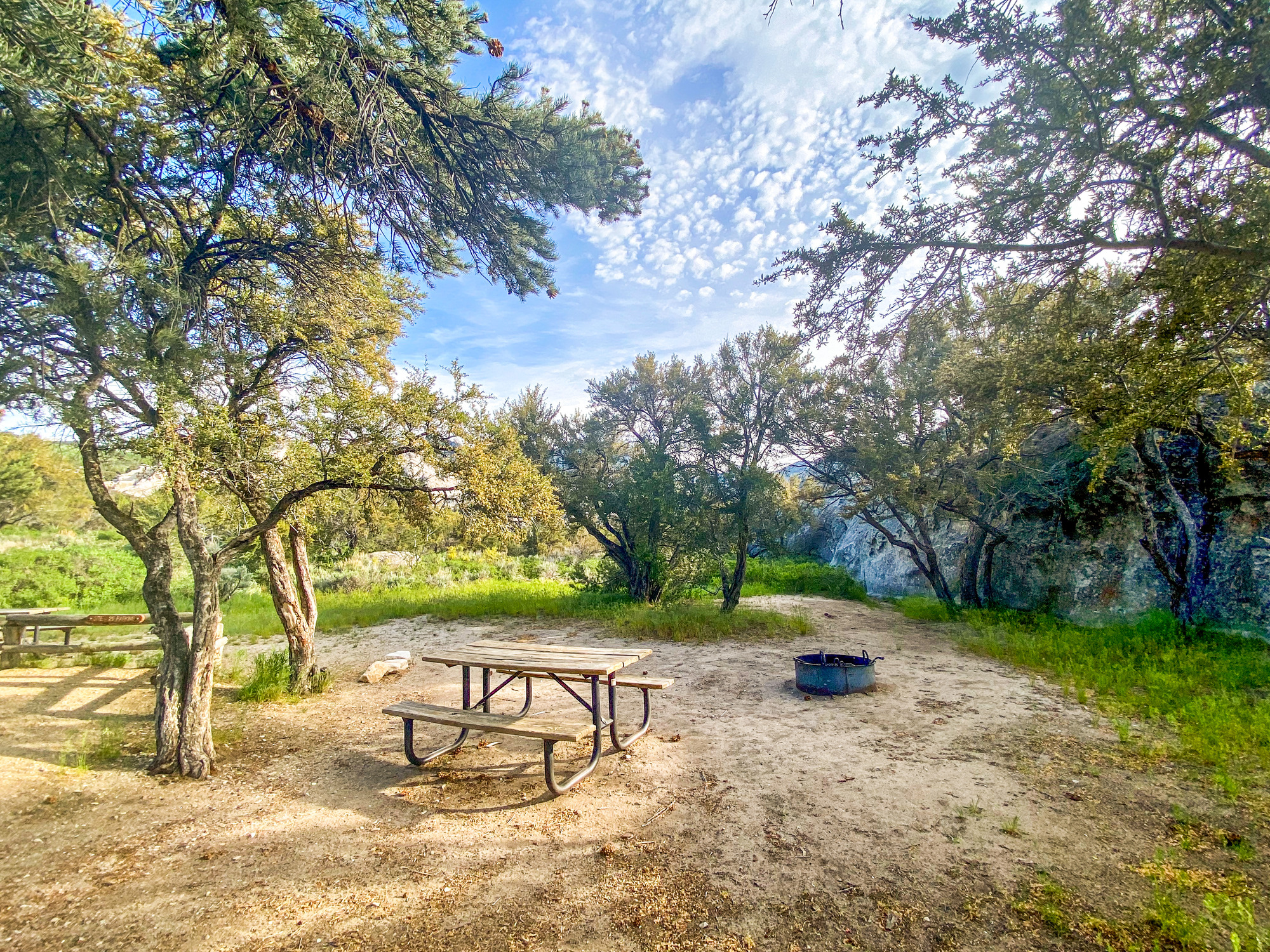
Campsite 39 picnic table and fire ring
Campsite 39 picnic table, fire ring and tent area with mahogany and pine trees.
rock, no tent pad, very good shade, can accommodate RV 18 ft or less.
Permission must be secured from the individual copyright owners to reproduce any copyrighted materials contained within this website. Digital assets without any copyright restrictions are public domain.
Public domain:Full Granting Rights
Image
City of Rocks National Reserve, Code: CIRO
Latitude: 42.0732194444444, Longitude: -113.713744444444, Elevation: 1924.08500590319
City of Rocks National Reserve, Cassia County, Idaho
Latitude: 42.0699005126953, Longitude: -113.71199798584
City of Rocks National Reserve, Cassia County, Idaho
Latitude: 42.0699005126953, Longitude: -113.71199798584
05/30/2020
05/30/2020
Public Can View
Wednesday, May 12, 2021 2:29:29 PM
Tuesday, June 17, 2025 4:55:02 PM
29b.jpg
jpg
13.3 MB
Scenic