Select Item below to DOWNLOAD - Once item is selected, right click and choose 'save as'
56cc9542-d3de-4b85-8534-9954eeeb1b71
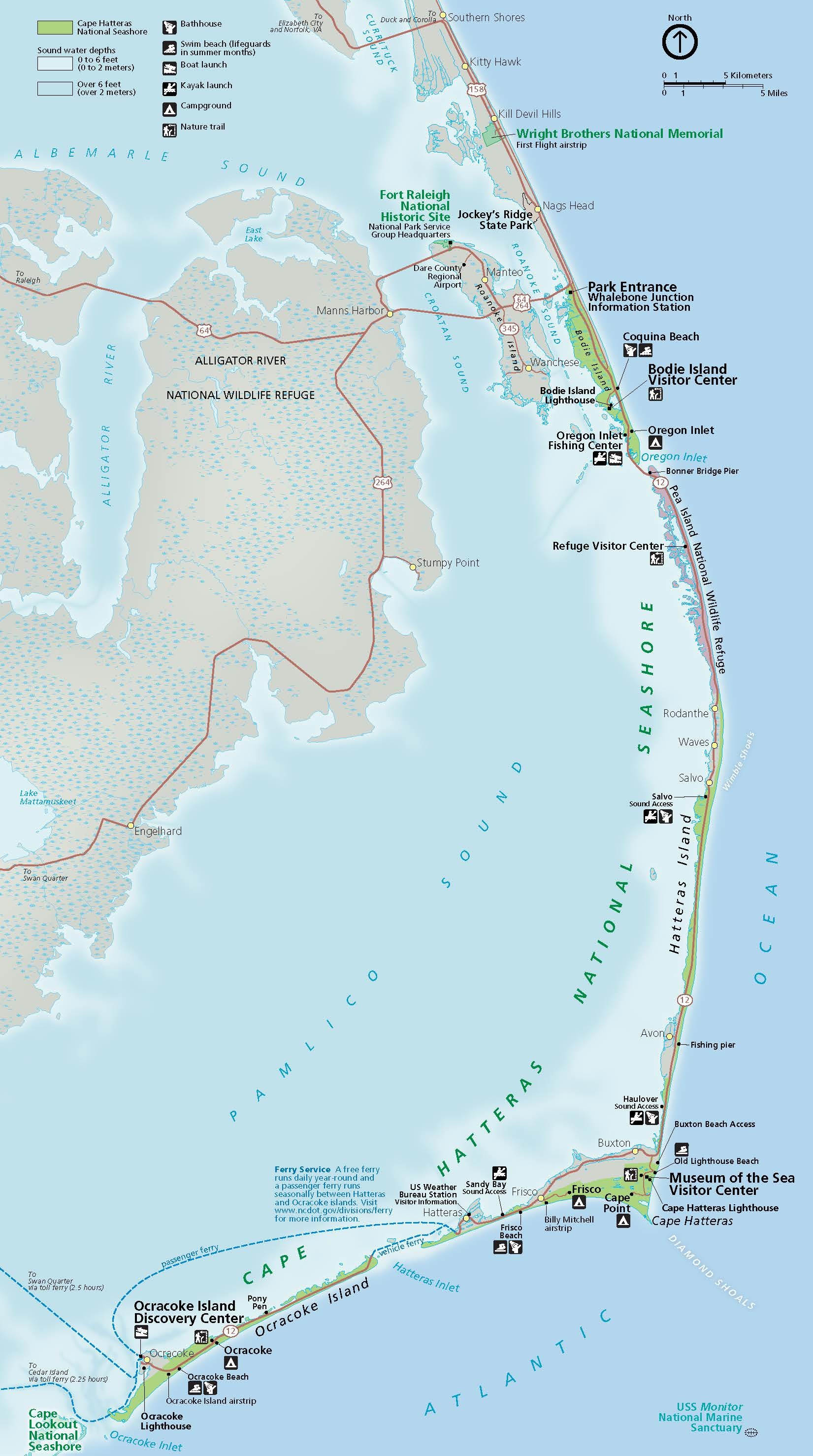
Park Map - Cape Hatteras National Seashore
Map of Cape Hatteras National Seashore in North Carolina. A string of islands, parks, and refuges enclose a series of sounds, which in turn curve around Alligator River National Wildlife Refuge. The refuge is shaded with blue diamonds on tan. Parks are shown in green, and water is represented in blue.
Screen-viewable file; Adobe print production files can be downloaded from the Compressed zip Version link
Map Projection: Other; Map Type: unassigned
U.S. National Park Service
The National Park Service maps are government produced and are in the public domain. Anyone may, without restriction under U.S. copyright laws: Reproduce the work in print or digital form; Create derivative works; Perform the work publicly; Display the work; Distribute copies or digitally transfer the work to the public by sale or other transfer of ownership, or by rental, lease, or lending. Please note, a user who modifies and/or republishes National Park Service maps are responsible for any problems encountered with the maps, due to their change or modification.
Public domain
Document
Cape Hatteras National Seashore, Code: CAHA
Cape Hatteras National Seashore, North Carolina
Latitude: 35.2368392944336, Longitude: -75.6029281616211
Latitude: 35.2368392944336, Longitude: -75.6029281616211
2022/05/01
Public Can View
Person: Harpers Ferry Center
Organization: US National Park Service
Address: Harpers Ferry Center, Harpers Ferry, WV
Email: HFC_Cartography@nps.gov
Organization: US National Park Service
Address: Harpers Ferry Center, Harpers Ferry, WV
Email: HFC_Cartography@nps.gov
Monday, April 25, 2022 4:49:13 PM
Friday, September 26, 2025 11:34:22 PM
CAHAmap1.pdf
pdf
21.5 MB
Map