Select Item below to DOWNLOAD - Once item is selected, right click and choose 'save as'
55c05b5f-adcf-4544-9cf1-75048c08a04c
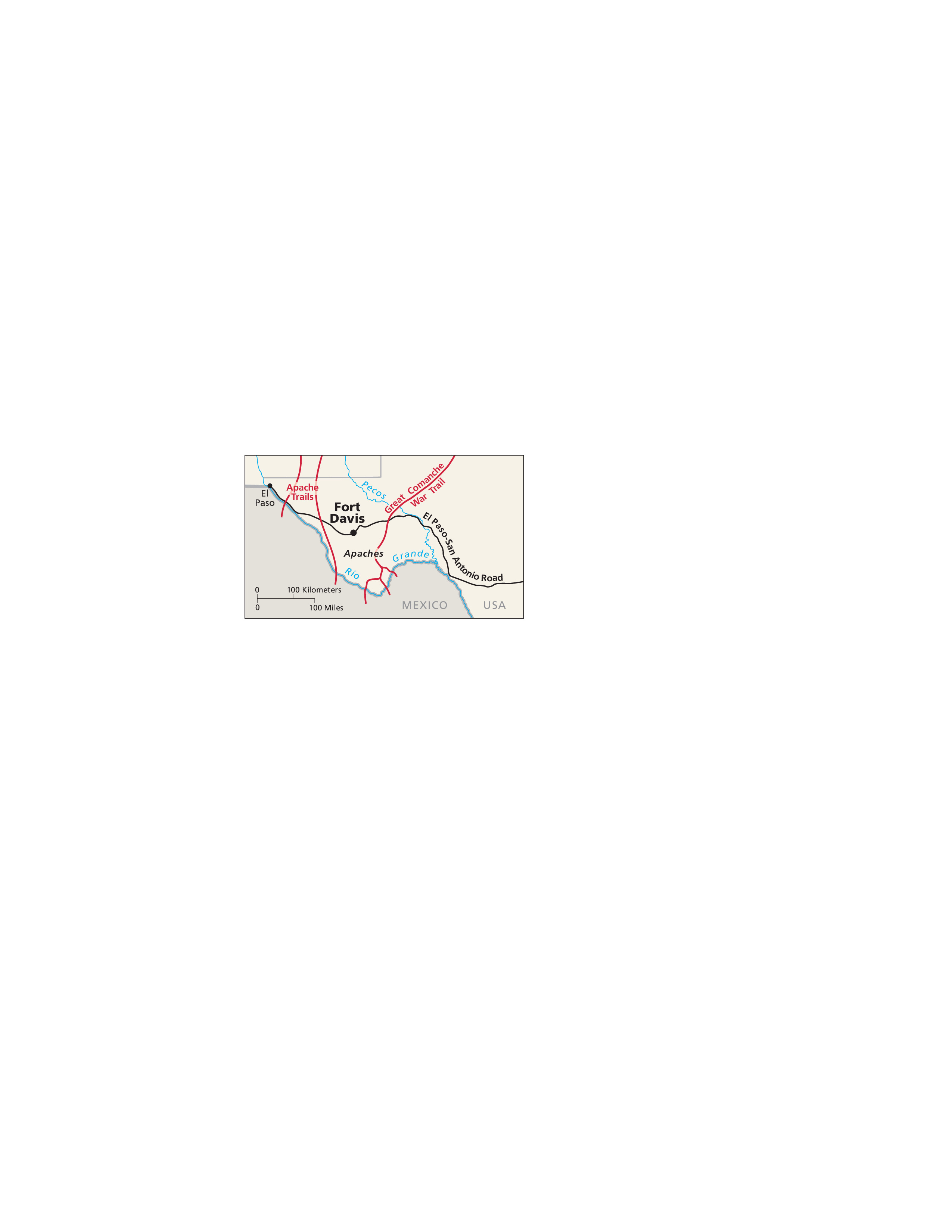
Indian Wars Map - Fort Davis National Historic Site
Indian Wars map for Fort Davis National Historic Site in Texas. The Rio Grande winds along the border between the United States, shown in beige, and Mexico in pale gray. Trails are shown as red lines and a road in black.
Screen-viewable file; Adobe print production files can be downloaded from the Compressed zip Version link
Map Projection: Other; Map Type: unassigned
U.S. National Park Service
The National Park Service maps are government produced and are in the public domain. Anyone may, without restriction under U.S. copyright laws: Reproduce the work in print or digital form; Create derivative works; Perform the work publicly; Display the work; Distribute copies or digitally transfer the work to the public by sale or other transfer of ownership, or by rental, lease, or lending. Please note, a user who modifies and/or republishes National Park Service maps are responsible for any problems encountered with the maps, due to their change or modification.
Public domain
Document
Fort Davis National Historic Site, Code: FODA
Fort Davis National Historic Site, Jeff Davis County, Texas
Latitude: 30.5993003845215, Longitude: -103.896003723145
Latitude: 30.5993003845215, Longitude: -103.896003723145
2011-03-28
Public Can View
Person: Harpers Ferry Center
Organization: US National Park Service
Address: Harpers Ferry Center, Harpers Ferry, WV
Email: HFC_Cartography@nps.gov
Organization: US National Park Service
Address: Harpers Ferry Center, Harpers Ferry, WV
Email: HFC_Cartography@nps.gov
Tuesday, April 26, 2022 2:00:20 PM
Friday, September 26, 2025 11:35:06 PM
FODAmap1.pdf
pdf
83.4 kB
Map