Select Item below to DOWNLOAD - Once item is selected, right click and choose 'save as'
54c3b29b76a34a82bf4619cf95a82230
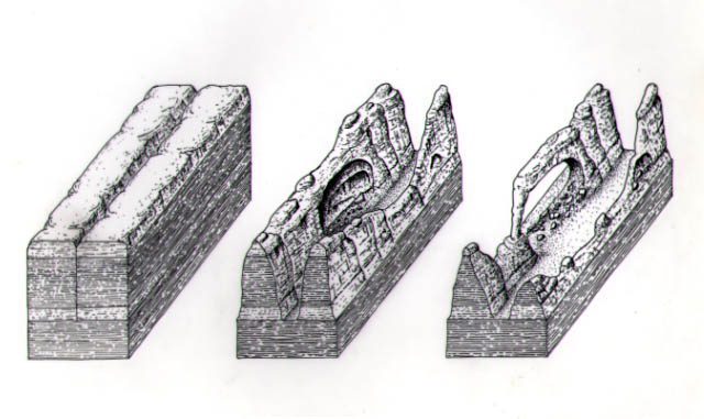
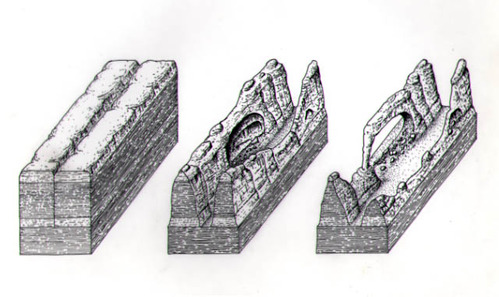
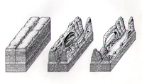
Series of block diagrams depicts the development of arch formations. The progressive erosional transformation begins from parallel cracks, through fins, and finally into arches.
Series of block diagrams depicts the development of arch formations. The progressive erosional transformation begins from parallel cracks, through fins, and finally into arches.
Abbr=EX
U.S. National Park Service
Project=Needles Visitor Center; Art_Registration_No=EX-0039 ; Reflective Art
Government owns art and all reproduction rights.
Public domain
Image
Canyonlands National Park, Code: CANY
Canyonlands National Park, Utah
Latitude: 38.2717704772949, Longitude: -109.883102416992
Latitude: 38.2717704772949, Longitude: -109.883102416992
Image Management System : IMS 07247
20190904
01/01/1996 - 12/30/1996
Image_Size=9" x 11 3/4"; Count:6/6; Graphic # G-11-5-2
K15
Public Can View
Organization: Harpers Ferry Center
Address: Harpers Ferry Center, 67 Mather Place, Harpers Ferry, WV, 25425, 304-535-5050
Address: Harpers Ferry Center, 67 Mather Place, Harpers Ferry, WV, 25425, 304-535-5050
Monday, October 7, 2019 2:45:32 PM
Monday, October 7, 2019 2:45:32 PM
07247.jpg
jpg
52.6 kB
Museum