Select Item below to DOWNLOAD - Once item is selected, right click and choose 'save as'
542778ea-8b7c-415d-bfef-6d2c45c2f583
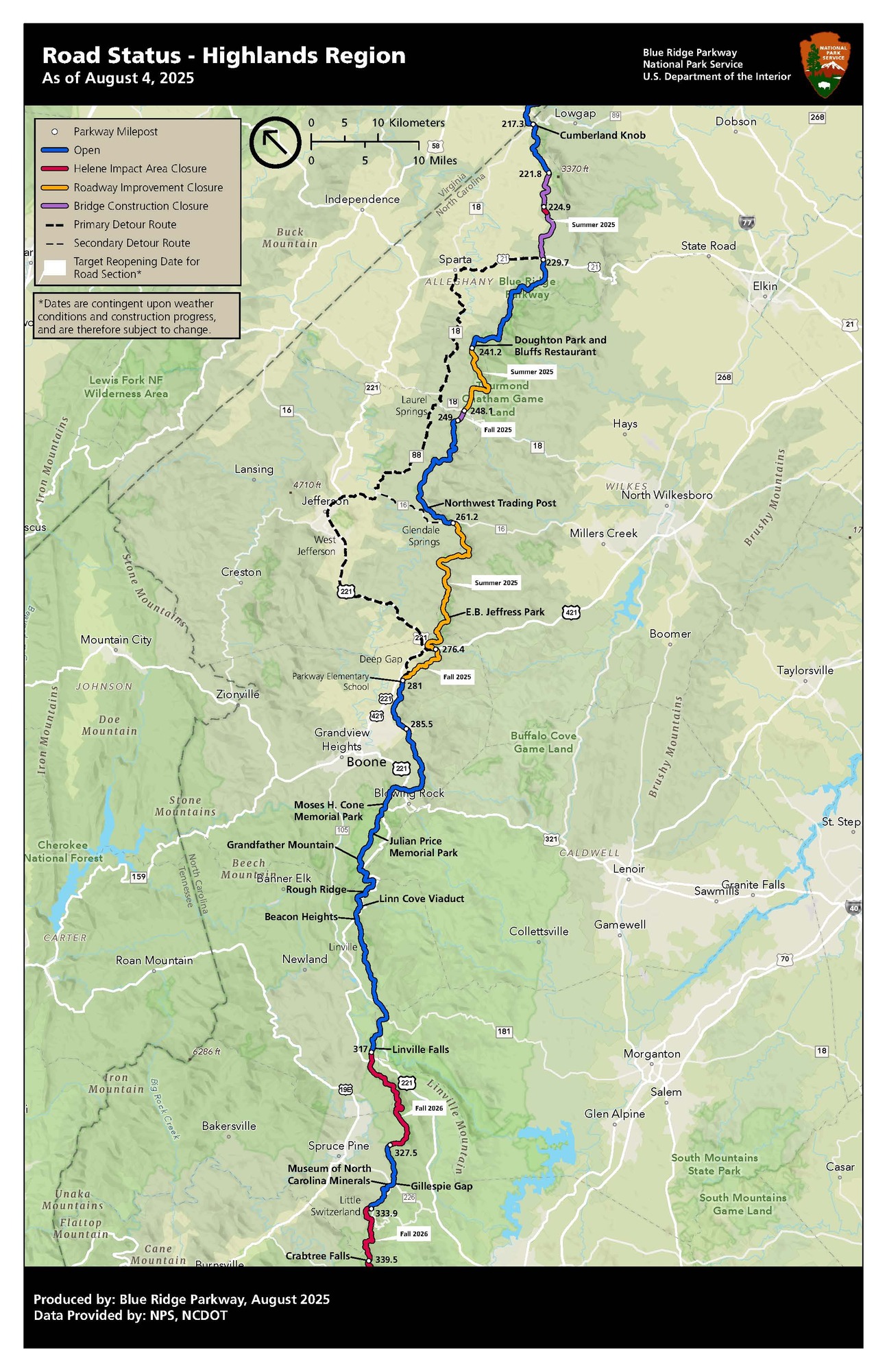
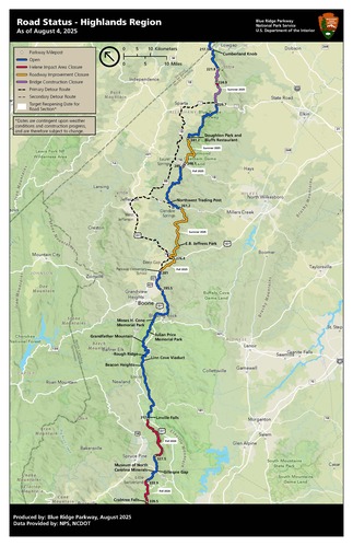
August 4, 2025 Helene Road Status Highlands NC
Map showing road status for Highlands region of NC with detours, open and closed sections of the Parkway, and target re-opening dates for closed sections.
Map showing road status for Highlands region of NC with detours, open and closed sections of the Parkway, and target re-opening dates for closed sections.
Permission must be secured from the individual copyright owners to reproduce any copyrighted materials contained within this website. Digital assets without any copyright restrictions are public domain.
NPS Photo
Public domain:Full Granting Rights
Image
Blue Ridge Parkway, Code: BLRI
Blue Ridge Parkway
Latitude: 36.4365005493164, Longitude: -81.070556640625
Latitude: 36.4365005493164, Longitude: -81.070556640625
08/04/2025
01/01/0001
Public Can View
Monday, August 4, 2025 1:15:15 PM
Wednesday, August 6, 2025 6:48:18 PM
HeleneRoadStatus_Highlands_20250801 (004).jpg
Monday, January 1, 0001 12:00:00 AM
jpg
556.9 kB
Scenic