Select Item below to DOWNLOAD - Once item is selected, right click and choose 'save as'
52ecaab2-b8d0-46bc-a2f9-095593caadb6
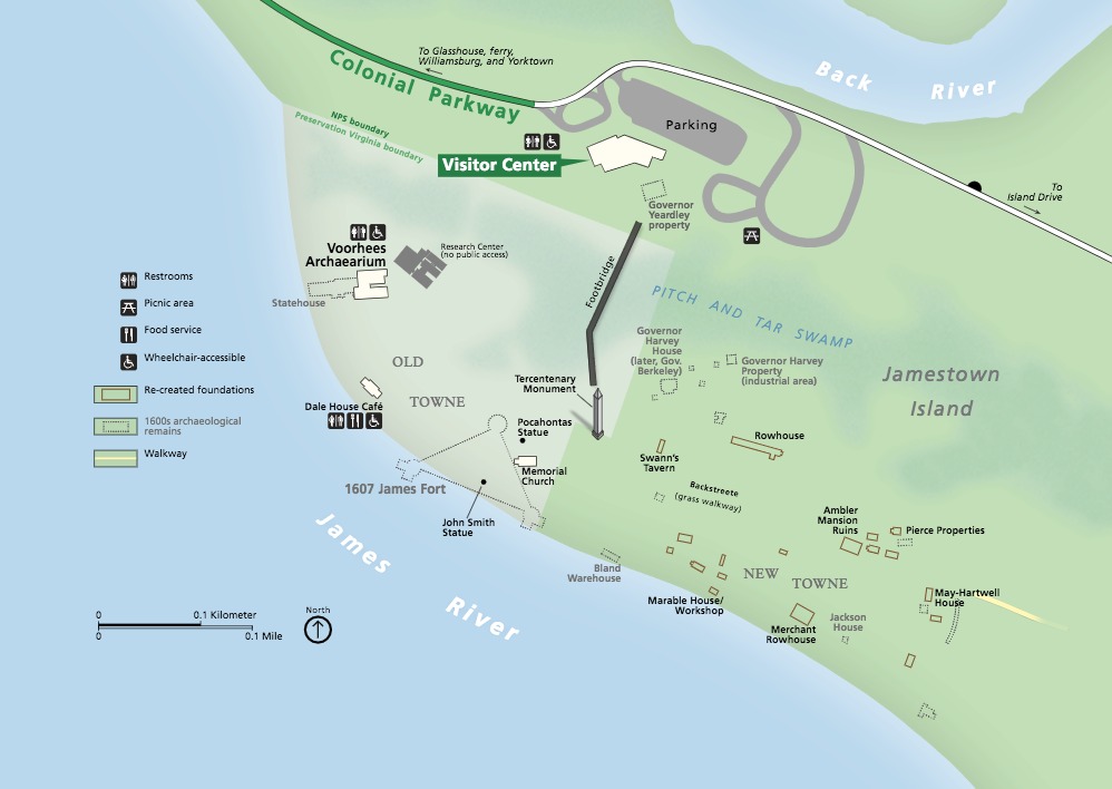
Jamestown Map - Colonial National Historical Park
Map of Jamestown Island in Colonial National Historical Park in Virginia. The James River, shown in blue, fills the lower left third of the map and the Back River curves across the top right corner. Most of Jamestown Island is shown shaded in green except one wedge, which is paler green and represents the Preservation Virginia boundary.
Screen-viewable file; Adobe print production files can be downloaded from the Compressed zip Version link
Map Projection: WM; Map Type: park map
U.S. National Park Service
The National Park Service maps are government produced and are in the public domain. Anyone may, without restriction under U.S. copyright laws: Reproduce the work in print or digital form; Create derivative works; Perform the work publicly; Display the work; Distribute copies or digitally transfer the work to the public by sale or other transfer of ownership, or by rental, lease, or lending. Please note, a user who modifies and/or republishes National Park Service maps are responsible for any problems encountered with the maps, due to their change or modification.
Public domain
Document
Colonial National Historical Park, Code: COLO
Colonial National Historical Park, Virginia
Latitude: 37.2880897521973, Longitude: -76.6342163085938
Latitude: 37.2880897521973, Longitude: -76.6342163085938
2018-10-30
Public Can View
Person: Harpers Ferry Center
Organization: US National Park Service
Address: Harpers Ferry Center, Harpers Ferry, WV
Email: HFC_Cartography@nps.gov
Organization: US National Park Service
Address: Harpers Ferry Center, Harpers Ferry, WV
Email: HFC_Cartography@nps.gov
Monday, April 25, 2022 4:38:57 PM
Friday, September 26, 2025 11:34:40 PM
COLOJamestownMap.pdf
pdf
4.5 MB
Map