Select Item below to DOWNLOAD - Once item is selected, right click and choose 'save as'
4721dc9d-25ce-4557-94ed-2494496a3c3e
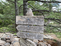
Day Mountain Summit SIgn
The elevation sign at the top of Day Mountain (593 ft/180 m).
The elevation sign at the top of Day Mountain (593 ft/180 m).
Permission must be secured from the individual copyright owners to reproduce any copyrighted materials contained within this website. Digital assets without any copyright restrictions are public domain.
NPS Photo by John Branciforte
Public domain:Full Granting Rights
Image
Acadia National Park, Code: ACAD
Acadia National Park, Maine
Latitude: 44.3593788146973, Longitude: -68.2397308349609
Latitude: 44.3593788146973, Longitude: -68.2397308349609
05/29/2025
05/29/2025
Public Can View
Wednesday, August 20, 2025 11:33:03 PM
Wednesday, August 20, 2025 11:39:36 PM
Day Mountain SIgn.JPG
Apple Apple, iPhone SE (2nd generation) 20, iPhone SE (2nd generation) back camera 3.99mm f/1.8
1/175 sec at f / 1.8
3.99 mm
ISO 20
Thursday, May 29, 2025 12:20:00 PM
jpg
6.5 MB
Scenic