Select Item below to DOWNLOAD - Once item is selected, right click and choose 'save as'
4059c32a9202471c9f34e7420f6d6959
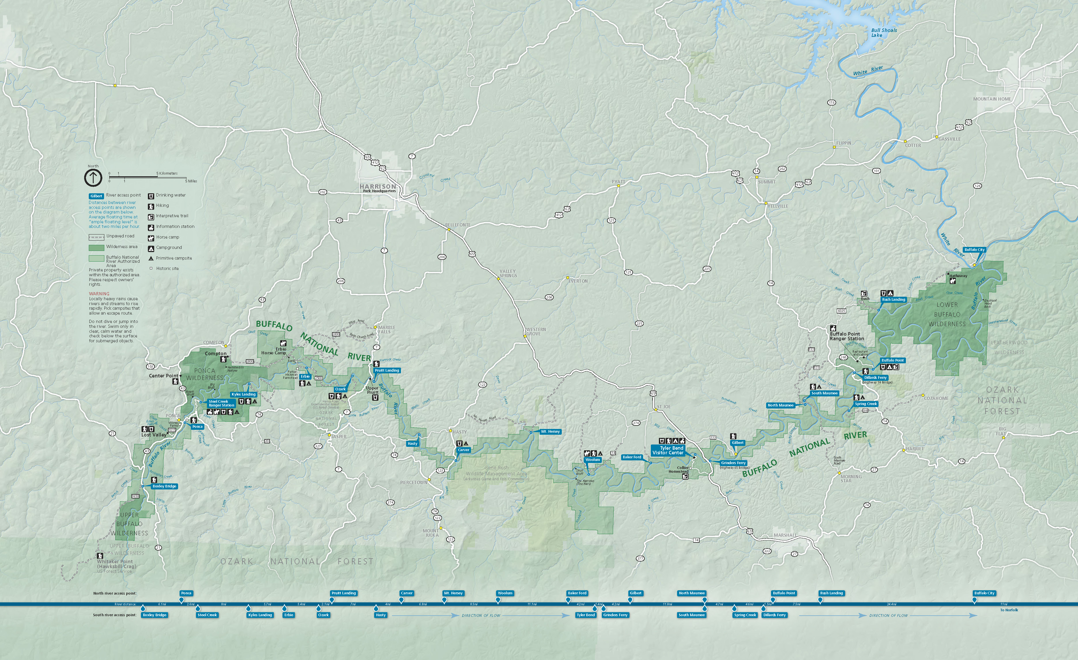
Park Map - Buffalo National River
Map of Buffalo National River in Arkansas. The river is represented in blue and the surrounding park areas are shades of green. The river and park curve like a shallow S on its side across the bottom half of the map.
Screen-viewable file; Adobe print production files can be downloaded from the Compressed zip Version link
Map Projection: WM; Map Type: park map
U.S. National Park Service
The National Park Service maps are government produced and are in the public domain. Anyone may, without restriction under U.S. copyright laws: Reproduce the work in print or digital form; Create derivative works; Perform the work publicly; Display the work; Distribute copies or digitally transfer the work to the public by sale or other transfer of ownership, or by rental, lease, or lending. Please note, a user who modifies and/or republishes National Park Service maps are responsible for any problems encountered with the maps, due to their change or modification.
Public domain
Document
Buffalo National River, Code: BUFF
Buffalo National River, Arkansas
Latitude: 35.9686393737793, Longitude: -92.9181137084961
Latitude: 35.9686393737793, Longitude: -92.9181137084961
2018-11-06
Public Can View
Person: Harpers Ferry Center
Organization: US National Park Service
Address: Harpers Ferry Center, Harpers Ferry, WV
Email: HFC_Cartography@nps.gov
Organization: US National Park Service
Address: Harpers Ferry Center, Harpers Ferry, WV
Email: HFC_Cartography@nps.gov
Friday, April 22, 2022 8:46:53 PM
Friday, September 26, 2025 11:34:20 PM
BUFFParkMap.pdf
pdf
16.0 MB
Map