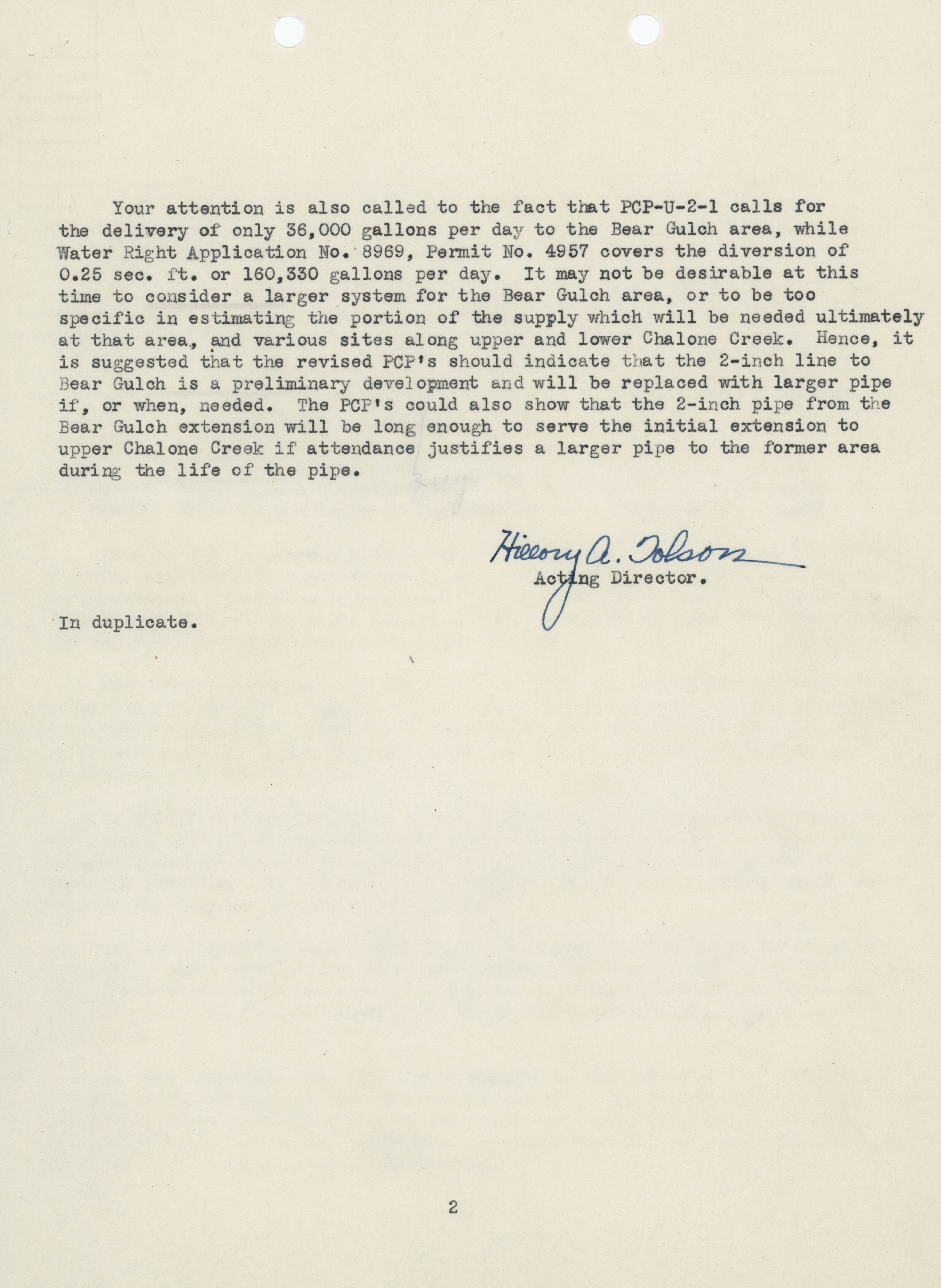
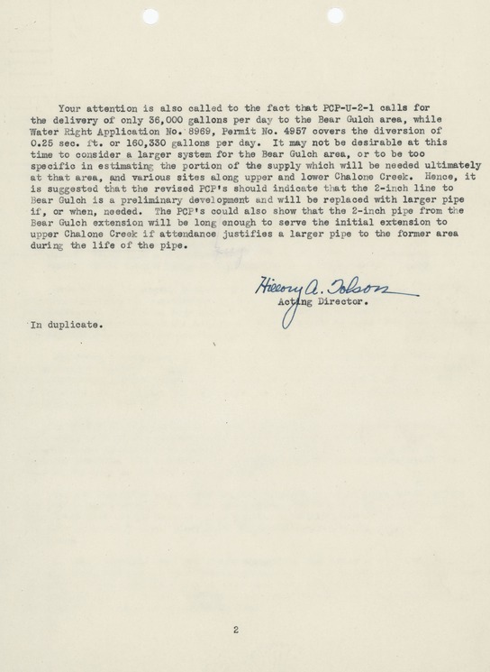
Select Item below to DOWNLOAD - Once item is selected, right click and choose 'save as'
3d9cc19c-23d0-43b2-bd8f-64a226de0e51
Advance Survey and Planning Program Memorandum
Advance Survey and Planning Program Memorandum
Advance Survey and Planning Program Memorandum
U.S. National Parks Service
This digital asset is in the public domain. When using this asset for any purpose, including online, credit: 'Courtesy U.S. National Parks, Pinnacles National Park'
NPS
Public domain
Document
Pinnacles National Park, Code: PINN
Pinnacles National Park, California
Latitude: 36.4753494262695, Longitude: -121.173400878906
Latitude: 36.4753494262695, Longitude: -121.173400878906
1944/08/23
Original ID Lands, Buildings, Roads, and Trails: Development 1942-1949, 8.5 x 11 inches
Manuscript: Page 49 ; Catalog NO: 3658 ; Box NO: Box 5 ; Folder NO: 7
Public Can View
Organization: Pinnacles National Park
Address: 5000 East Entrance Rd., Paicines, CA 95043, tel: 831-389-4486
Address: 5000 East Entrance Rd., Paicines, CA 95043, tel: 831-389-4486
Monday, May 19, 2025 9:09:20 PM
Monday, May 19, 2025 9:09:20 PM
PINN_3658_0911.tif
tif
31.9 MB
Historic